Area Overview for IG8 8FB
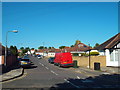
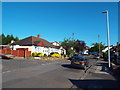
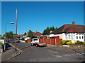
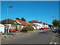
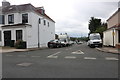
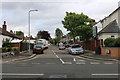
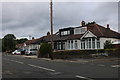
Photos of IG8 8FB


Area Information
Living in IG8 8FB means being part of a tightly knit residential cluster in England, home to 2,026 people. This small postcode area is characterised by a focus on family-oriented living, with a median age of 47 and a strong presence of adults aged 30–64. The community is predominantly owner-occupied, with 57% of homes owned by residents, and the accommodation is largely houses rather than flats. The area’s compact nature means daily life is shaped by proximity to local amenities, schools, and transport links. While it lacks large-scale commercial hubs, its practical reach includes retail outlets, multiple railway stations, and connections to London’s transport network. The absence of environmental constraints like protected woodlands or AONB designations makes it a straightforward place to live, with no planning restrictions complicating development. For those seeking a quiet, stable neighbourhood with access to essentials, IG8 8FB offers a balance of convenience and simplicity.
- Area Type
- Postcode
- Area Size
- Not available
- Population
- 2026
- Population Density
- 4187 people/km²
The property market in IG8 8FB is dominated by owner-occupied homes, with 57% of properties owned by residents. This contrasts with the 43% rented, suggesting a market where long-term residency is more common than short-term lettings. The area’s housing stock is largely composed of houses, which are typically larger and more suited to families than flats. Given the small size of the postcode area, the housing stock is limited, meaning buyers may face competition for available properties. The predominance of houses also implies that the area is less likely to cater to younger professionals or students seeking smaller units. For those considering purchase, the owner-occupied nature of the market may indicate a stable investment, though the limited supply could mean higher prices or fewer choices in the immediate vicinity.
House Prices in IG8 8FB
No properties found in this postcode.
Energy Efficiency in IG8 8FB
The lifestyle in IG8 8FB is shaped by its proximity to a range of amenities. Local shops include Tesco Woodford, Co-op South, and Sainsburys South, providing everyday essentials within walking or short driving distance. For transport, residents have access to five metro stations, five rail stations, and a bus interchange, ensuring easy movement around the area and beyond. The presence of London City Airport nearby adds to the area’s connectivity, while the East India Pier ferry offers a rare maritime link. Though the area lacks large parks or leisure facilities, the practical reach of retail and transport hubs suggests a focus on convenience over expansive recreational spaces. The mix of retail, transport, and travel options creates a functional environment where daily needs are met without the need for long commutes, supporting a lifestyle that balances practicality with accessibility.
Amenities
Schools
Residents of IG8 8FB have access to Beal High School, which serves as both a primary and academy school with an Ofsted rating of ‘good’. This dual role provides families with a single institution covering early education through to secondary schooling, reducing the need for multiple school commutes. The Beacon Business Innovation Hub, while not a traditional school, adds a layer of professional development opportunities for older students or local businesses. The presence of a ‘good’-rated academy suggests a reliable educational foundation, though the absence of additional schools may limit options for those seeking alternative curricula or special needs support. Families relying on this single primary school should consider proximity to ensure ease of access, as the area’s small size means travel times could be significant for those living further afield.
| Rank | School | Type | Entry gender | Ages |
|---|
Explore more schools in this area
Go to Schools tabDemographics
The population of IG8 8FB skews towards adults aged 30–64, with a median age of 47. This suggests a mature, established community, likely with a mix of long-term residents and families. Home ownership is strong at 57%, indicating a stable housing market with fewer rental properties. The area is predominantly composed of houses, which aligns with the demographic profile of older, settled households. The predominant ethnic group is Asian_total, reflecting a culturally distinct community. While no deprivation data is provided, the high home ownership rate and age distribution suggest a relatively secure financial position for residents. The absence of younger demographics may mean fewer schools catering to children under 11, though the area does host a primary school. Overall, the population structure points to a community focused on stability, with limited turnover and a clear generational trend.
Household Size
Accommodation Type
Tenure
Ethnic Group
Religion
Household Composition
Age
Household Deprivation
NS-SEC
Explore more demographic insights in this area
Go to Demographics tabPlanning
Planning Constraints
- Flood RiskPremium
- Ramsar Wetland SitesPremium
- Area of Outstanding Natural BeautyPremium
- Protected Nature ReservePremium
- Protected WoodlandPremium