Area Overview for IG8 0UP
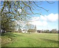
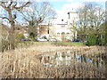
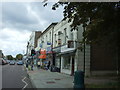
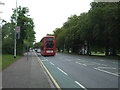
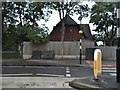
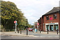
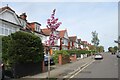
Photos of IG8 0UP


Area Information
Living in IG8 0UP means being part of a tightly knit residential cluster in England, where 1,913 people reside across 8,755 square metres. The area’s density is striking — over 218,000 people per square kilometre — suggesting a compact, perhaps older community. This postcode is defined by its flat-dominated housing stock, reflecting a mix of owner-occupied and rental properties. The median age of 47 points to a mature population, with adults aged 30–64 forming the largest group. Daily life here is likely shaped by proximity to transport hubs, with rail, metro, and bus links nearby. While the area lacks natural or protected landscapes, its small size means amenities and services are within practical reach. Residents may find the balance between urban convenience and residential tranquility appealing, though the high population density could influence the pace of life. For those seeking a compact, connected community with access to essential services, IG8 0UP offers a focused, if limited, living environment.
- Area Type
- Postcode
- Area Size
- 8755 m²
- Population
- 1913
- Population Density
- 5127 people/km²
The property market in IG8 0UP is defined by its flat-dominated housing stock, with 52% of homes owner-occupied and the remaining 48% likely rented. This suggests a balance between long-term residents and transient tenants, though the small area size (8,755 m²) limits the availability of diverse property types. Flats may dominate due to the area’s compact nature, making it more suited to those prioritising convenience over larger living spaces. For buyers, the market is likely constrained by the postcode’s small footprint, with limited scope for expansion or development. The high population density may also influence property values, with demand potentially outstripping supply. Those seeking a flat in a connected, urban setting may find this area appealing, though the lack of detached homes could be a drawback for some buyers.
House Prices in IG8 0UP
Showing 9 properties
| Address | Type | Beds | Baths | Last Sale Price | Last Sale Date | |
|---|---|---|---|---|---|---|
| 2C High Elms, Woodford Green, IG8 0UP | Flat | 2 | 1 | £430,000 | Jan 2018 | |
| 2B High Elms, Woodford Green, IG8 0UP | Flat | 1 | - | £190,000 | Aug 2013 | |
| Higham Villa, 3 High Elms, Woodford Green, IG8 0UP | house | - | - | £744,000 | Oct 2009 | |
| 2A High Elms, Woodford Green, IG8 0UP | Flat | - | - | £144,000 | Aug 2009 | |
| 1A High Elms, Woodford Green, IG8 0UP | Flat | 3 | - | - | - | |
| 2, Elm Terrace, High Elms, Woodford Green, IG8 0UP | Terraced | 4 | - | - | - | |
| 1, Elm Terrace, High Elms, Woodford Green, IG8 0UP | house | 3 | - | - | - | |
| 3, Elm Terrace, High Elms, Woodford Green, IG8 0UP | Terraced | - | - | - | - | |
| 1 High Elms, Woodford Green, IG8 0UP | Terraced | - | - | - | - |
Energy Efficiency in IG8 0UP
Residents of IG8 0UP have access to a range of nearby amenities, including five retail outlets such as Sainsburys Woodford Green and Cook Woodford, offering everyday shopping needs. Public transport is well-served by five rail stations, three metro stops, and the Whipps Cross Bus Interchange, facilitating easy travel to surrounding areas. While the area lacks detailed information on parks or leisure facilities, the presence of multiple transport options and retail choices suggests a practical, convenience-focused lifestyle. The compact nature of the postcode means amenities are within close reach, though the absence of specific data on recreational spaces limits a full picture of the area’s character.
Amenities
Schools
Residents of IG8 0UP have access to two independent schools: Woodford Green Preparatory School and B A D Junior Conductive Education. Both institutions are privately run, offering alternatives to state education. Independent schools often provide smaller class sizes, specialist facilities, and tailored curricula, which may appeal to families prioritising specific educational approaches. However, the absence of state school data means the full range of options for families with varying budgets or preferences remains unclear. The presence of independent schools suggests the area may attract households seeking private education, though the suitability for different family needs depends on individual priorities and financial capacity.
| Rank | School | Type | Entry gender | Ages |
|---|
Explore more schools in this area
Go to Schools tabDemographics
The community in IG8 0UP is predominantly middle-aged, with a median age of 47 and the majority of residents falling within the 30–64 age range. Home ownership stands at 52%, indicating a mix of owner-occupied and rental properties. Flats are the primary accommodation type, reflecting a housing stock suited to urban living rather than detached homes. The predominant ethnic group is White, though specific data on diversity or deprivation is not provided. The high population density — over 218,000 people per square kilometre — suggests a tightly packed residential area, potentially influencing the character of local interactions. For those considering the area, the age profile implies a stable, possibly family-oriented community, though the lack of detailed diversity metrics means broader demographic trends remain unexplored.
Household Size
Accommodation Type
Tenure
Ethnic Group
Religion
Household Composition
Age
Household Deprivation
NS-SEC
Explore more demographic insights in this area
Go to Demographics tabPlanning
Planning Constraints
- Flood RiskPremium
- Ramsar Wetland SitesPremium
- Area of Outstanding Natural BeautyPremium
- Protected Nature ReservePremium
- Protected WoodlandPremium