Area Overview for IG8 0TP
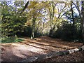
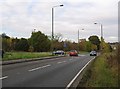
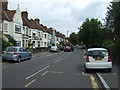
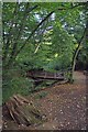
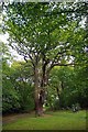
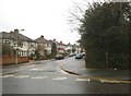
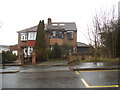
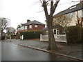
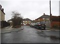
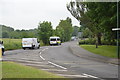
Photos of IG8 0TP


Area Information
Living in IG8 0TP means inhabiting a compact, residential postcode area with a population of 1,618 spread across 8,312 square metres. This small cluster is densely populated, with 194,653 people per square kilometre, reflecting a tight-knit community. The area is characterised by its mix of family homes and established neighbourhoods, catering to a demographic skewed towards adults aged 30–64. Daily life here is shaped by proximity to essential services, schools, and transport links, making it practical for commuters and families alike. While the area lacks natural or protected landscapes, its focus on residential stability and accessibility to urban amenities offers a straightforward lifestyle. IG8 0TP is not a sprawling suburb but a defined postcode cluster, where local shops, schools, and transport hubs form the backbone of community interaction. Its appeal lies in its simplicity: a place where home ownership is high, and the rhythm of life is dictated by nearby infrastructure rather than sprawling green spaces.
- Area Type
- Postcode
- Area Size
- 8312 m²
- Population
- 1618
- Population Density
- 2527 people/km²
The property market in IG8 0TP is dominated by owner-occupied homes, with 81% of residents living in properties they own. This high rate of home ownership suggests a stable, long-term demographic, with fewer rental properties available. The accommodation type is predominantly houses, indicating a focus on family-sized homes rather than flats or apartments. Given the area’s small size, the housing stock is limited, making it a niche market for buyers seeking established properties in a compact postcode. The lack of new developments or high-density housing means the market is unlikely to experience rapid growth. For buyers, this translates to a focus on existing homes, often with mature gardens and traditional layouts. The area’s proximity to transport links and schools may also influence property values, though the small footprint of IG8 0TP means competition for available homes is likely.
House Prices in IG8 0TP
Showing 1 properties
| Address | Type | Beds | Baths | Last Sale Price | Last Sale Date | |
|---|---|---|---|---|---|---|
| Sixth Form, Trinity Catholic Upper High School, Mornington Road, Woodford Green, IG8 0TP | commercial | - | - | - | - |
Energy Efficiency in IG8 0TP
Residents of IG8 0TP have access to a range of practical amenities within walking or short driving distance. Retail options include Co-op Hatch, Sainsburys Woodford Green, and the Chelmsford Star Co-operative Society, providing everyday shopping needs. The area’s transport hubs, such as Whipps Cross Bus Interchange, facilitate access to broader leisure and employment opportunities. While there are no named parks or recreational spaces in the data, the proximity to urban centres likely means nearby green spaces are accessible. The mix of retail, transport, and schools creates a self-contained lifestyle, where daily errands and social activities are manageable without long commutes. The compact nature of the area means amenities are concentrated, reducing the need for extensive travel. This focus on practicality suits those prioritising convenience over expansive leisure facilities.
Amenities
Schools
The schools near IG8 0TP offer a range of options for families, from state-funded primary schools to independent institutions. Wells Primary School, rated outstanding by Ofsted, provides a high standard of education for younger children. St Antony’s Catholic Primary School and Trinity Catholic High School both hold good ratings, offering faith-based education within the state sector. For independent schooling, Avon House Preparatory School is also rated good, while Bancroft’s School, though not rated, is a well-known independent institution. This mix of school types ensures families can choose between state and private education, with varying levels of academic performance and ethos. The presence of multiple schools within practical reach reduces the need for long commutes, supporting a family-friendly environment. The quality of local education is a key draw for parents seeking reliable schooling for their children.
| Rank | School | Type | Entry gender | Ages |
|---|
Explore more schools in this area
Go to Schools tabDemographics
The community in IG8 0TP is predominantly composed of adults aged 30–64, with a median age of 47. This suggests a mature, settled population, likely with established careers and family structures. Home ownership is exceptionally high at 81%, indicating a preference for long-term residency over rental properties. The accommodation type is primarily houses, reinforcing a family-oriented housing stock. The predominant ethnic group is White, reflecting a homogenous demographic profile. The population density of 194,653 people per square kilometre underscores the area’s compact nature, where proximity to neighbours is inevitable. While this density may limit personal space, it also fosters a sense of community. The absence of specific deprivation data means the quality of life is likely tied to the availability of local services and transport, which are well-developed in this area.
Household Size
Accommodation Type
Tenure
Ethnic Group
Religion
Household Composition
Age
Household Deprivation
NS-SEC
Explore more demographic insights in this area
Go to Demographics tabPlanning
Planning Constraints
- Flood RiskPremium
- Ramsar Wetland SitesPremium
- Area of Outstanding Natural BeautyPremium
- Protected Nature ReservePremium
- Protected WoodlandPremium