Area Overview for IG8 0TE
Photos of IG8 0TE
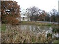
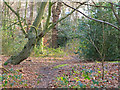
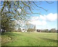
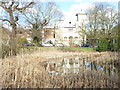

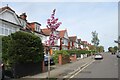
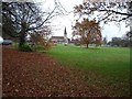
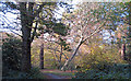
29 photos from this area
Area Information
Key information about the IG8 0TE including its size, population, and administrative classification.
- Area Type
- Postcode
- Area Size
- 7298 m²
- Population
- 1618
- Population Density
- 2527 people/km²
House Prices in IG8 0TE
15
Properties
£753,800
Average Sold Price
£285,000
Lowest Price
£1,180,000
Highest Price
Showing 15 properties
| Address | Type | Beds | Baths | Last Sale Price | Last Sale Date | |
|---|---|---|---|---|---|---|
| 20 Chestnut Walk, Woodford Green, IG8 0TE | Detached | 4 | 2 | £1,180,000 | Mar 2025 | |
| 24 Chestnut Walk, Woodford Green, IG8 0TE | Semi-detached | 4 | 1 | £995,000 | Mar 2023 | |
| 1 Chestnut Walk, Woodford Green, IG8 0TE | Detached | 4 | 2 | £875,000 | Jan 2022 | |
| 26 Chestnut Walk, Woodford Green, IG8 0TE | Semi-detached | 3 | 1 | £490,500 | Dec 2020 | |
| 22 Chestnut Walk, Woodford Green, IG8 0TE | Semi-detached | 5 | - | £1,067,000 | Aug 2019 | |
| 30 Chestnut Walk, Woodford Green, IG8 0TE | Terraced | 2 | - | £476,000 | Mar 2018 | |
| 18 Chestnut Walk, Woodford Green, IG8 0TE | Detached | 4 | 2 | £930,000 | Nov 2017 | |
| 10 Chestnut Walk, Woodford Green, IG8 0TE | Semi-detached | 3 | 1 | £582,000 | Oct 2012 | |
| 9 Chestnut Walk, Woodford Green, IG8 0TE | Detached | - | - | £657,500 | Dec 2006 | |
| 28 Chestnut Walk, Woodford Green, IG8 0TE | Semi-detached | - | - | £285,000 | Aug 2006 |
Page 1 of 2
Energy Efficiency in IG8 0TE
Amenities
Schools
| Rank | School | Type | Entry gender | Ages |
|---|
Explore more schools in this area
Go to Schools tabDemographics
Household Size
Two person
most common
Accommodation Type
Houses
most common
Tenure
81
majority
Ethnic Group
White
most common
Religion
N/A
most common
Household Composition
N/A
most common
Age
47
median
Adults (30-64 years)
most common
Household Deprivation
N/A
with no deprivation
NS-SEC
50
in Lower managerial occupations
Explore more demographic insights in this area
Go to Demographics tabPlanning
Planning Constraints
- Flood RiskPremium
- Ramsar Wetland SitesPremium
- Area of Outstanding Natural BeautyPremium
- Protected Nature ReservePremium
- Protected WoodlandPremium