Area Overview for IG8 0NW
Photos of IG8 0NW
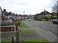
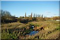
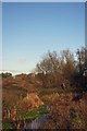
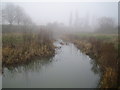


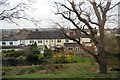

39 photos from this area
Area Information
Key information about the IG8 0NW including its size, population, and administrative classification.
- Area Type
- Postcode
- Area Size
- 1.4 hectares
- Population
- 1412
- Population Density
- 2891 people/km²
House Prices in IG8 0NW
25
Properties
£689,029
Average Sold Price
£147,000
Lowest Price
£1,540,000
Highest Price
Showing 25 properties
| Address | Type | Beds | Baths | Last Sale Price | Last Sale Date | |
|---|---|---|---|---|---|---|
| 145 Monkhams Lane, Woodford Green, IG8 0NW | Detached | 4 | 3 | £1,212,500 | Jul 2025 | |
| 109 Monkhams Lane, Woodford Green, IG8 0NW | Retail | 4 | 2 | £1,220,000 | Nov 2022 | |
| 133 Monkhams Lane, Woodford Green, IG8 0NW | Semi-detached | 3 | - | £1,030,000 | Sep 2021 | |
| 149 Monkhams Lane, Woodford Green, IG8 0NW | house | - | - | £1,350,000 | Jun 2021 | |
| 135 Monkhams Lane, Woodford Green, IG8 0NW | house | - | - | £1,540,000 | Jun 2021 | |
| 107 Monkhams Lane, Woodford Green, IG8 0NW | Semi-detached | 4 | 3 | £955,000 | Oct 2018 | |
| 111 Monkhams Lane, Woodford Green, IG8 0NW | Semi-detached | 4 | 2 | £400,000 | Sep 2015 | |
| 117 Monkhams Lane, Woodford Green, IG8 0NW | Semi-detached | 4 | - | £735,000 | Mar 2014 | |
| 113 Monkhams Lane, Woodford Green, IG8 0NW | house | - | - | £633,000 | Feb 2014 | |
| 103 Monkhams Lane, Woodford Green, IG8 0NW | Semi-detached | 4 | 2 | £515,000 | Apr 2007 |
Page 1 of 3
Energy Efficiency in IG8 0NW
Amenities
Schools
| Rank | School | Type | Entry gender | Ages |
|---|
Explore more schools in this area
Go to Schools tabDemographics
Household Size
Family (3-5 people)
most common
Accommodation Type
Houses
most common
Tenure
92
majority
Ethnic Group
White
most common
Religion
N/A
most common
Household Composition
N/A
most common
Age
47
median
Adults (30-64 years)
most common
Household Deprivation
N/A
with no deprivation
NS-SEC
52
in Lower managerial occupations
Explore more demographic insights in this area
Go to Demographics tabPlanning
Planning Constraints
- Flood RiskPremium
- Ramsar Wetland SitesPremium
- Area of Outstanding Natural BeautyPremium
- Protected Nature ReservePremium
- Protected WoodlandPremium