Area Overview for IG8 0AE
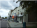
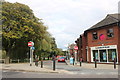
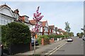
Photos of IG8 0AE


Area Information
Living in IG8 0AE means being part of a small, tightly knit residential cluster in England, home to just 1,636 people. This area is defined by its proximity to transport networks, with multiple metro, rail, and bus routes within practical reach. Daily life here is shaped by a balance of quiet living and accessible urban conveniences. The community is predominantly composed of adults aged 30–64, reflecting a mature demographic with a strong presence of homeowners. While the area is small, it benefits from being near larger hubs like Woodford Green and Chelmsford, offering a blend of local amenities and regional connectivity. Residents can enjoy a mix of retail options, from supermarkets to co-operative societies, alongside regular public transport links that make commuting to nearby towns straightforward. The area’s compact nature means that essential services are within walking or short driving distance, creating a self-contained yet connected environment. For those seeking a place that feels both private and practical, IG8 0AE offers a foundation of stability with the flexibility of nearby opportunities.
- Area Type
- Postcode
- Area Size
- Not available
- Population
- 1636
- Population Density
- 4039 people/km²
The property market in IG8 0AE is dominated by owner-occupied homes, with 75% of residents owning their properties. This high level of home ownership points to a community that values stability and long-term investment. The predominant accommodation type is houses, which suggests a focus on family-friendly living and larger properties compared to flats or apartments. Given the small population and compact size of the area, the housing stock is likely to be limited in volume, with properties concentrated around key transport routes and local amenities. For buyers, this means a market that prioritises quality over quantity, with homes typically situated in established residential clusters. The emphasis on houses may appeal to those seeking space and privacy, though the limited availability could mean competition for available properties. Buyers should also consider the area’s proximity to larger towns like Woodford Green, which may offer additional options for those seeking more extensive housing markets.
House Prices in IG8 0AE
No properties found in this postcode.
Energy Efficiency in IG8 0AE
Residents of IG8 0AE have access to a range of amenities within easy reach. Retail options include Sainsburys Woodford Green, Chelmsford Star Co-operative Society, and Cook Woodford, providing everyday shopping needs. The area’s transport links are a key feature, with metro stations like Roding Valley and Buckhurst Hill Underground Station, rail stations such as Highams Park and Chingford, and the Whipps Cross Bus Interchange offering multiple commuting routes. These connections make it simple to access larger towns or London. While the area itself is small, its proximity to nearby hubs means residents can enjoy a broader selection of dining, leisure, and cultural activities. The presence of multiple transport options also enhances convenience, reducing the need for long journeys. The balance of local shops and regional connectivity creates a lifestyle that is both practical and adaptable, supporting both daily routines and occasional excursions.
Amenities
Schools
| Rank | School | Type | Entry gender | Ages |
|---|
Explore more schools in this area
Go to Schools tabDemographics
The population of IG8 0AE is 1,636, with a median age of 47. This indicates a community skewed towards middle-aged adults, with the most common age range being 30–64 years. Home ownership is high, at 75%, suggesting a strong presence of long-term residents and family homes. The predominant accommodation type is houses, which aligns with the area’s residential character and the demographic profile of its occupants. The predominant ethnic group is White, though no specific data on diversity or deprivation is provided. The age distribution implies a stable, established population with fewer young families or elderly residents compared to other areas. This profile may influence local services and amenities, which are tailored to the needs of working-age adults and homeowners. The high home ownership rate also suggests a community with a focus on permanence and investment in property, which can be a factor for prospective buyers considering long-term residency.
Household Size
Accommodation Type
Tenure
Ethnic Group
Religion
Household Composition
Age
Household Deprivation
NS-SEC
Explore more demographic insights in this area
Go to Demographics tabPlanning
Planning Constraints
- Flood RiskPremium
- Ramsar Wetland SitesPremium
- Area of Outstanding Natural BeautyPremium
- Protected Nature ReservePremium
- Protected WoodlandPremium