Area Overview for IG5 0GZ
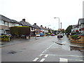
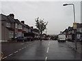
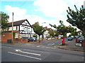
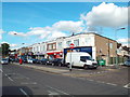
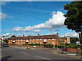
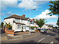
Photos of IG5 0GZ


Area Information
Living in IG5 0GZ means being part of a small, tightly knit residential cluster in England, home to 1,667 people. This postcode area is characterised by its compact size and proximity to essential services, making it a practical choice for those seeking a balance between urban convenience and suburban calm. The area’s population is predominantly composed of adults aged 30–64, reflecting a mature community with established roots. Daily life here is shaped by its accessibility to transport networks, retail hubs, and educational institutions. The presence of multiple schools, including Parkhill Junior and Infants’ Schools, ensures families have options for primary education. While the area lacks natural landscapes like AONBs or protected woodlands, its strategic location near Gants Hill Station and London City Airport provides strong connectivity. Residents benefit from excellent broadband scores, enabling seamless remote work or online activities. However, the moderate crime risk score of 55 means standard security measures are advisable. For those prioritising practicality, IG5 0GZ offers a straightforward, no-frills lifestyle with a focus on accessibility and stability.
- Area Type
- Postcode
- Area Size
- Not available
- Population
- 1667
- Population Density
- 8116 people/km²
The property market in IG5 0GZ is dominated by owner-occupied homes, with 81% of residents owning their properties. This high rate of home ownership suggests a stable, long-term community with limited rental activity. The accommodation type is primarily houses, which is unusual for areas with higher flat density. This may indicate a preference for single-family homes, potentially appealing to families or those seeking more private living spaces. However, the small population size of 1,667 and the focus on houses imply a limited inventory of properties, which could make the market competitive for buyers. The area’s proximity to transport links and schools may enhance its appeal, though the lack of detailed data on property prices or trends means buyers should consider the broader regional market. For those prioritising home ownership and space, IG5 0GZ offers a niche opportunity, but its small size means surrounding areas may need to be explored for more options.
House Prices in IG5 0GZ
No properties found in this postcode.
Energy Efficiency in IG5 0GZ
The lifestyle in IG5 0GZ is shaped by its proximity to a range of amenities. Residents have access to five retail outlets, including Co-op Ilford, Tesco Gants, and Iceland Barkingside, providing everyday shopping convenience. The area’s transport links extend to multiple metro, rail, and bus stations, including Gants Hill and Ilford, facilitating easy travel to work, leisure, or social events. Nearby, London City Airport and ferry services at Woolwich and East India Piers add to the area’s connectivity. For recreation, the absence of protected natural sites means green spaces may be limited, but the compact layout ensures most amenities are within walking distance. The presence of multiple schools and retail options fosters a community-focused environment, where daily needs are met without long commutes. While the area lacks expansive parks, its practical layout and accessibility make it suitable for those prioritising efficiency over large-scale leisure facilities.
Amenities
Schools
Residents of IG5 0GZ have access to two primary schools: Parkhill Junior School and Parkhill Infants’ School, both of which hold an Ofsted rating of ‘good’. These institutions provide a consistent educational option for young children, with the dual presence of junior and infants’ schools ensuring continuity in primary education. The ‘good’ rating suggests that both schools meet national standards in teaching quality, pupil outcomes, and overall performance. For families, this proximity to two schools reduces the need for long commutes and offers flexibility in choosing between different educational environments. However, the absence of secondary schools in the immediate area means parents may need to consider nearby options. The availability of primary education at a high standard is a key factor for families prioritising schooling in their housing decisions.
| Rank | School | Type | Entry gender | Ages |
|---|
Explore more schools in this area
Go to Schools tabDemographics
The community in IG5 0GZ is predominantly composed of adults aged 30–64, with a median age of 47. This suggests a population that is largely settled, with fewer young families or retirees compared to other areas. Home ownership is high, at 81%, indicating a stable, long-term resident base. The accommodation type is primarily houses, which aligns with the area’s residential character and may appeal to those seeking more space than flats. The predominant ethnic group is Asian, reflecting a culturally diverse population. While specific data on deprivation is not provided, the high home ownership rate and presence of essential amenities suggest a relatively stable quality of life. The age profile implies a community with established careers and family structures, potentially contributing to a quiet, low-traffic environment. However, the absence of detailed socioeconomic data means broader conclusions about deprivation or affluence cannot be drawn.
Household Size
Accommodation Type
Tenure
Ethnic Group
Religion
Household Composition
Age
Household Deprivation
NS-SEC
Explore more demographic insights in this area
Go to Demographics tabPlanning
Planning Constraints
- Flood RiskPremium
- Ramsar Wetland SitesPremium
- Area of Outstanding Natural BeautyPremium
- Protected Nature ReservePremium
- Protected WoodlandPremium