Area Overview for IG4 5EY
Photos of IG4 5EY
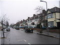
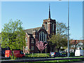
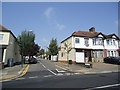
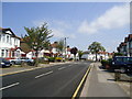
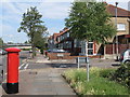
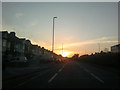

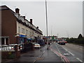
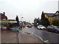
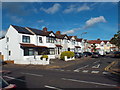
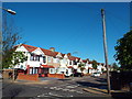
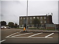
35 photos from this area
Area Information
Key information about the IG4 5EY including its size, population, and administrative classification.
- Area Type
- Postcode
- Area Size
- 5562 m²
- Population
- 1941
- Population Density
- 10232 people/km²
House Prices in IG4 5EY
20
Properties
£344,000
Average Sold Price
£73,000
Lowest Price
£685,000
Highest Price
Showing 20 properties
| Address | Type | Beds | Baths | Last Sale Price | Last Sale Date | |
|---|---|---|---|---|---|---|
| 71 Redbridge Lane East, Ilford, IG4 5EY | Terraced | 3 | 3 | £400,000 | Apr 2025 | |
| 91 Redbridge Lane East, Ilford, IG4 5EY | Semi-detached | 4 | 1 | £575,000 | Jun 2024 | |
| 75 Redbridge Lane East, Ilford, IG4 5EY | house | - | - | £500,000 | Mar 2021 | |
| 81 Redbridge Lane East, Ilford, IG4 5EY | Terraced | 4 | 2 | £685,000 | Jan 2020 | |
| 89 Redbridge Lane East, Ilford, IG4 5EY | house | - | - | £325,000 | Jul 2011 | |
| 69 Redbridge Lane East, Ilford, IG4 5EY | Terraced | 2 | 1 | £180,500 | Nov 2002 | |
| 67 Redbridge Lane East, Ilford, IG4 5EY | house | - | - | £212,500 | Jul 2001 | |
| 85 Redbridge Lane East, Ilford, IG4 5EY | Terraced | - | - | £145,000 | Sep 2000 | |
| 79 Redbridge Lane East, Ilford, IG4 5EY | Terraced | 3 | 1 | £73,000 | Jun 1995 | |
| The Vintry, 53-63 Redbridge Lane East, Ilford, IG4 5EY | office_workshop | - | - | - | - |
Page 1 of 2
Energy Efficiency in IG4 5EY
Amenities
Schools
| Rank | School | Type | Entry gender | Ages |
|---|
Explore more schools in this area
Go to Schools tabDemographics
Household Size
Family (3-5 people)
most common
Accommodation Type
Houses
most common
Tenure
72
majority
Ethnic Group
asian_total
most common
Religion
N/A
most common
Household Composition
N/A
most common
Age
47
median
Adults (30-64 years)
most common
Household Deprivation
N/A
with no deprivation
NS-SEC
33
in Lower managerial occupations
Explore more demographic insights in this area
Go to Demographics tabPlanning
Planning Constraints
- Flood RiskPremium
- Ramsar Wetland SitesPremium
- Area of Outstanding Natural BeautyPremium
- Protected Nature ReservePremium
- Protected WoodlandPremium