Area Overview for IG4 5AT
Photos of IG4 5AT
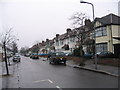
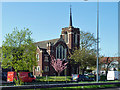
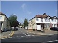
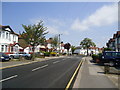
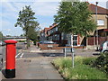
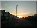

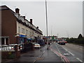
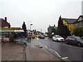
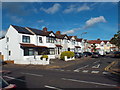
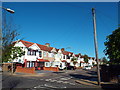
35 photos from this area
Area Information
Key information about the IG4 5AT including its size, population, and administrative classification.
- Area Type
- Postcode
- Area Size
- 8996 m²
- Population
- 1916
- Population Density
- 9351 people/km²
House Prices in IG4 5AT
31
Properties
£364,411
Average Sold Price
£80,500
Lowest Price
£665,000
Highest Price
Showing 31 properties
| Address | Type | Beds | Baths | Last Sale Price | Last Sale Date | |
|---|---|---|---|---|---|---|
| 271 Eastern Avenue, Ilford, IG4 5AT | Terraced | 3 | 1 | £565,000 | May 2024 | |
| 253 Eastern Avenue, Ilford, IG4 5AT | house | - | - | £610,000 | Aug 2023 | |
| 261 Eastern Avenue, Ilford, IG4 5AT | house | 3 | 1 | £665,000 | Jan 2023 | |
| 259 Eastern Avenue, Ilford, IG4 5AT | Semi-detached | 3 | 1 | £650,000 | Apr 2022 | |
| 283 Eastern Avenue, Ilford, IG4 5AT | house | 3 | 1 | £515,000 | Dec 2021 | |
| 269 Eastern Avenue, Ilford, IG4 5AT | house | - | - | £485,000 | Feb 2015 | |
| 291 Eastern Avenue, Ilford, IG4 5AT | house | 5 | - | £440,000 | Dec 2013 | |
| 257 Eastern Avenue, Ilford, IG4 5AT | house | 3 | - | £327,000 | Jan 2012 | |
| 275 Eastern Avenue, Ilford, IG4 5AT | house | - | - | £300,000 | Mar 2008 | |
| 263 Eastern Avenue, Ilford, IG4 5AT | Semi-detached | - | - | £379,995 | Jan 2007 |
Page 1 of 4
Energy Efficiency in IG4 5AT
Amenities
Schools
| Rank | School | Type | Entry gender | Ages |
|---|
Explore more schools in this area
Go to Schools tabDemographics
Household Size
Family (3-5 people)
most common
Accommodation Type
Houses
most common
Tenure
58
majority
Ethnic Group
asian_total
most common
Religion
N/A
most common
Household Composition
N/A
most common
Age
47
median
Adults (30-64 years)
most common
Household Deprivation
N/A
with no deprivation
NS-SEC
33
in Lower managerial occupations
Explore more demographic insights in this area
Go to Demographics tabPlanning
Planning Constraints
- Flood RiskPremium
- Ramsar Wetland SitesPremium
- Area of Outstanding Natural BeautyPremium
- Protected Nature ReservePremium
- Protected WoodlandPremium