Area Overview for IG4 5AB
Photos of IG4 5AB
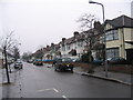
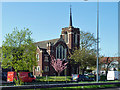
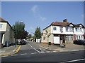
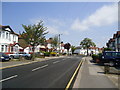
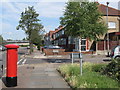
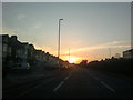

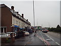
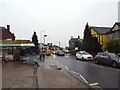
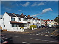
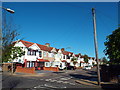
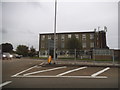
35 photos from this area
Area Information
Key information about the IG4 5AB including its size, population, and administrative classification.
- Area Type
- Postcode
- Area Size
- 1.2 hectares
- Population
- 1784
- Population Density
- 9287 people/km²
House Prices in IG4 5AB
23
Properties
£387,916
Average Sold Price
£76,000
Lowest Price
£690,000
Highest Price
Showing 23 properties
| Address | Type | Beds | Baths | Last Sale Price | Last Sale Date | |
|---|---|---|---|---|---|---|
| 250 Eastern Avenue, Ilford, IG4 5AB | Terraced | 3 | 1 | £550,000 | Jun 2024 | |
| 212 Eastern Avenue, Ilford, IG4 5AB | house | 3 | 1 | £315,000 | Jan 2023 | |
| 208 Eastern Avenue, Ilford, IG4 5AB | house | 1 | 12 | £690,000 | Aug 2021 | |
| 238 Eastern Avenue, Ilford, IG4 5AB | Terraced | 3 | 1 | £465,000 | Sep 2020 | |
| 218 Eastern Avenue, Ilford, IG4 5AB | Terraced | 5 | - | £620,000 | Aug 2019 | |
| 206 Eastern Avenue, Ilford, IG4 5AB | Terraced | 4 | 4 | £600,000 | Mar 2016 | |
| 240 Eastern Avenue, Ilford, IG4 5AB | Terraced | 5 | 3 | £440,000 | Mar 2015 | |
| 210 Eastern Avenue, Ilford, IG4 5AB | Terraced | 5 | 2 | £303,000 | Jan 2008 | |
| 248 Eastern Avenue, Ilford, IG4 5AB | house | 3 | - | £267,995 | Mar 2007 | |
| 242 Eastern Avenue, Ilford, IG4 5AB | Terraced | 3 | 1 | £250,000 | May 2005 |
Page 1 of 3
Energy Efficiency in IG4 5AB
Amenities
Schools
| Rank | School | Type | Entry gender | Ages |
|---|
Explore more schools in this area
Go to Schools tabDemographics
Household Size
Family (3-5 people)
most common
Accommodation Type
Houses
most common
Tenure
71
majority
Ethnic Group
asian_total
most common
Religion
N/A
most common
Household Composition
N/A
most common
Age
47
median
Adults (30-64 years)
most common
Household Deprivation
N/A
with no deprivation
NS-SEC
28
in Lower managerial occupations
Explore more demographic insights in this area
Go to Demographics tabPlanning
Planning Constraints
- Flood RiskPremium
- Ramsar Wetland SitesPremium
- Area of Outstanding Natural BeautyPremium
- Protected Nature ReservePremium
- Protected WoodlandPremium