Area Overview for IG2 7EU
Photos of IG2 7EU
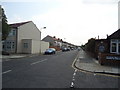
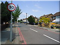
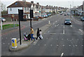
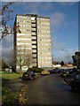
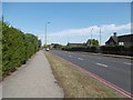
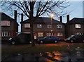
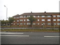
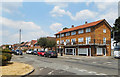
42 photos from this area
Area Information
Key information about the IG2 7EU including its size, population, and administrative classification.
- Area Type
- Postcode
- Area Size
- 2659 m²
- Population
- 1721
- Population Density
- 10349 people/km²
House Prices in IG2 7EU
13
Properties
£270,400
Average Sold Price
£222,000
Lowest Price
£380,000
Highest Price
Showing 13 properties
| Address | Type | Beds | Baths | Last Sale Price | Last Sale Date | |
|---|---|---|---|---|---|---|
| 29 Brook Road, Newbury Park, Ilford, IG2 7EU | Terraced | - | - | £247,000 | Mar 2024 | |
| 23 Brook Road, Newbury Park, Ilford, IG2 7EU | house | - | - | £380,000 | May 2021 | |
| 19 Brook Road, Newbury Park, Ilford, IG2 7EU | Terraced | - | - | £277,000 | Apr 2008 | |
| 31 Brook Road, Newbury Park, Ilford, IG2 7EU | house | 3 | - | £226,000 | Feb 2006 | |
| 21 Brook Road, Newbury Park, Ilford, IG2 7EU | Terraced | 3 | 2 | £222,000 | Jan 2004 | |
| 35 Brook Road, Newbury Park, Ilford, IG2 7EU | Terraced | 4 | 2 | - | - | |
| 15 Brook Road, Newbury Park, Ilford, IG2 7EU | Semi-detached | 5 | 1 | - | - | |
| Flat 2, 17 Brook Road, Newbury Park, Ilford, IG2 7EU | Flat | 3 | - | - | - | |
| Annexe Rear Of, 15 Brook Road, Newbury Park, Ilford, IG2 7EU | Flat | - | - | - | - | |
| 33 Brook Road, Newbury Park, Ilford, IG2 7EU | Terraced | - | - | - | - |
Page 1 of 2
Energy Efficiency in IG2 7EU
Amenities
Schools
| Rank | School | Type | Entry gender | Ages |
|---|
Explore more schools in this area
Go to Schools tabDemographics
Household Size
Family (3-5 people)
most common
Accommodation Type
Houses
most common
Tenure
67
majority
Ethnic Group
asian_total
most common
Religion
N/A
most common
Household Composition
N/A
most common
Age
47
median
Adults (30-64 years)
most common
Household Deprivation
N/A
with no deprivation
NS-SEC
33
in Lower managerial occupations
Explore more demographic insights in this area
Go to Demographics tabPlanning
Planning Constraints
- Flood RiskPremium
- Ramsar Wetland SitesPremium
- Area of Outstanding Natural BeautyPremium
- Protected Nature ReservePremium
- Protected WoodlandPremium