Area Overview for IG2 7DZ
Photos of IG2 7DZ
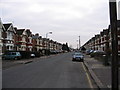
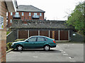

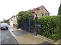
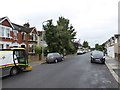
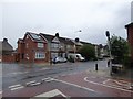
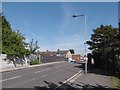
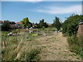

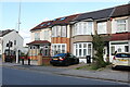

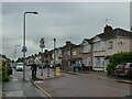
53 photos from this area
Area Information
Key information about the IG2 7DZ including its size, population, and administrative classification.
- Area Type
- Postcode
- Area Size
- 1.4 hectares
- Population
- 2496
- Population Density
- 9846 people/km²
House Prices in IG2 7DZ
29
Properties
£364,192
Average Sold Price
£110,000
Lowest Price
£565,000
Highest Price
Showing 29 properties
| Address | Type | Beds | Baths | Last Sale Price | Last Sale Date | |
|---|---|---|---|---|---|---|
| 111 Wards Road, Newbury Park, Ilford, IG2 7DZ | house | - | - | £340,000 | Nov 2022 | |
| 101 Wards Road, Newbury Park, Ilford, IG2 7DZ | Terraced | 2 | 1 | £522,500 | Dec 2020 | |
| 101A Wards Road, Newbury Park, Ilford, IG2 7DZ | Semi-detached | 4 | 1 | £375,000 | Feb 2019 | |
| 119 Wards Road, Newbury Park, Ilford, IG2 7DZ | Semi-detached | 4 | 2 | £565,000 | Sep 2018 | |
| 115 Wards Road, Newbury Park, Ilford, IG2 7DZ | Terraced | 4 | - | £565,000 | Mar 2018 | |
| 141 Wards Road, Newbury Park, Ilford, IG2 7DZ | Semi-detached | 3 | - | £500,000 | Jan 2018 | |
| 129 Wards Road, Newbury Park, Ilford, IG2 7DZ | Semi-detached | 3 | 1 | £500,000 | Jan 2016 | |
| 143 Wards Road, Newbury Park, Ilford, IG2 7DZ | Detached | 5 | 2 | £275,000 | Apr 2008 | |
| 103 Wards Road, Newbury Park, Ilford, IG2 7DZ | Terraced | 3 | 2 | £305,000 | Aug 2007 | |
| 123 Wards Road, Newbury Park, Ilford, IG2 7DZ | Terraced | - | - | £300,000 | Mar 2007 |
Page 1 of 3
Energy Efficiency in IG2 7DZ
Amenities
Schools
| Rank | School | Type | Entry gender | Ages |
|---|
Explore more schools in this area
Go to Schools tabDemographics
Household Size
Family (3-5 people)
most common
Accommodation Type
Houses
most common
Tenure
58
majority
Ethnic Group
asian_total
most common
Religion
N/A
most common
Household Composition
N/A
most common
Age
47
median
Adults (30-64 years)
most common
Household Deprivation
N/A
with no deprivation
NS-SEC
28
in Lower managerial occupations
Explore more demographic insights in this area
Go to Demographics tabPlanning
Planning Constraints
- Flood RiskPremium
- Ramsar Wetland SitesPremium
- Area of Outstanding Natural BeautyPremium
- Protected Nature ReservePremium
- Protected WoodlandPremium