Area Overview for IG2 6HR
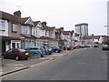
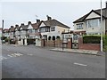
Photos of IG2 6HR


Area Information
Living in IG2 6HR offers a compact, residential experience within a small cluster of homes. With a population of 2163, the area is characterised by its close-knit community and proximity to essential services. The postcode sits in a part of England where daily life balances suburban comfort with practical connectivity. Residents benefit from a range of nearby amenities, including schools, retail outlets, and transport links, making it suitable for families and commuters. The area’s modest size means it is likely to have a distinct local identity, shaped by its residents’ routines and the availability of nearby facilities. While not a sprawling suburb, IG2 6HR provides access to major transport hubs like Gants Hill Station and London City Airport, ensuring residents are well-connected to surrounding regions. The mix of housing types and community diversity contributes to a lived-in feel, with a median age of 47 suggesting a stable, mature demographic. For those seeking a manageable, service-rich environment, this postcode may offer a blend of practicality and community.
- Area Type
- Postcode
- Area Size
- Not available
- Population
- 2163
- Population Density
- 10650 people/km²
The property market in IG2 6HR is defined by its focus on houses, with 48% of residents owning their homes. This suggests a balance between owner-occupied properties and rental units, though the exact proportion of rentals is not specified. The predominance of houses may indicate a preference for larger living spaces, which could be attractive to families or those prioritising privacy. Given the area’s small size, the housing stock is likely limited, making it a niche market for buyers seeking specific properties. The relatively low home ownership rate could imply a higher proportion of renters, potentially influenced by local employment patterns or affordability factors. For buyers, this means the area may have fewer properties available compared to larger suburbs, requiring a targeted search. The mix of housing types and community profile suggests that IG2 6HR is not a high-end market but rather a practical option for those seeking a residential area with accessible amenities.
House Prices in IG2 6HR
No properties found in this postcode.
Energy Efficiency in IG2 6HR
Residents of IG2 6HR enjoy a range of amenities within easy reach. Retail options include major supermarkets like Tesco Gants, Sainsburys Gants Hill, and Iceland Gants, ensuring daily shopping needs are met. The area’s transport hubs, such as Gants Hill Station and London City Airport, provide access to broader leisure and business opportunities. For dining and leisure, the proximity to ferry services like Woolwich Ferry North Pier and East India Pier offers waterfront activities, though these may require a short journey. The presence of multiple schools and community facilities suggests a family-friendly environment. While the area is compact, its connectivity to larger suburbs via rail and bus networks means residents can access more extensive cultural or recreational options beyond IG2 6HR. The mix of retail, transport, and nearby natural amenities contributes to a balanced lifestyle, blending convenience with practicality.
Amenities
Schools
Residents of IG2 6HR have access to several schools, including primary institutions such as Gearies Infants’ School, Gearies Junior School, and Gearies Primary School, which holds an Ofsted rating of outstanding. These state-funded schools provide foundational education for younger children, while the nearby Abeng International Independent School offers an alternative for families seeking private education. The presence of both state and independent options reflects the area’s appeal to diverse educational preferences. Gearies Primary School’s high Ofsted rating indicates strong performance in teaching and student outcomes, which may be a key consideration for families prioritising academic quality. The concentration of primary schools suggests that the area is well-suited for families with young children, reducing the need for long commutes to education. However, the absence of secondary schools within the postcode may require residents to travel to nearby areas for further education.
| Rank | School | Type | Entry gender | Ages |
|---|
Explore more schools in this area
Go to Schools tabDemographics
The community in IG2 6HR is predominantly composed of adults aged 30-64, with a median age of 47. This suggests a population that is largely established, with many likely to be in their prime working years or nearing retirement. Home ownership stands at 48%, indicating a mix of owner-occupied properties and rental units. The accommodation type is primarily houses, which may appeal to those seeking more space or privacy compared to flats. The predominant ethnic group is the Asian_total category, reflecting a specific cultural and demographic profile. This composition may influence local traditions, languages spoken, and community activities. While no specific deprivation data is provided, the age range and home ownership figures suggest a relatively stable population with established ties to the area. The presence of both state and independent schools nearby further indicates that the area caters to families seeking varied educational options.
Household Size
Accommodation Type
Tenure
Ethnic Group
Religion
Household Composition
Age
Household Deprivation
NS-SEC
Explore more demographic insights in this area
Go to Demographics tabPlanning
Planning Constraints
- Flood RiskPremium
- Ramsar Wetland SitesPremium
- Area of Outstanding Natural BeautyPremium
- Protected Nature ReservePremium
- Protected WoodlandPremium