Area Overview for IG2 6AH
Photos of IG2 6AH
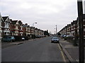
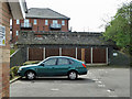
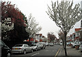
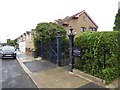
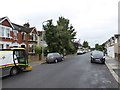
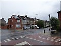
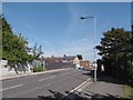
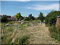

53 photos from this area
Area Information
Key information about the IG2 6AH including its size, population, and administrative classification.
- Area Type
- Postcode
- Area Size
- 1.5 hectares
- Population
- 2413
- Population Density
- 11069 people/km²
House Prices in IG2 6AH
47
Properties
£247,286
Average Sold Price
£58,000
Lowest Price
£575,000
Highest Price
Showing 47 properties
| Address | Type | Beds | Baths | Last Sale Price | Last Sale Date | |
|---|---|---|---|---|---|---|
| 23 Cranley Drive, Newbury Park, Ilford, IG2 6AH | Terraced | 3 | 1 | £560,000 | Mar 2025 | |
| 21 Cranley Drive, Newbury Park, Ilford, IG2 6AH | Terraced | 3 | 1 | £575,000 | Mar 2025 | |
| 18 Cranley Drive, Newbury Park, Ilford, IG2 6AH | house | - | - | £272,100 | Aug 2024 | |
| 54 Cranley Drive, Newbury Park, Ilford, IG2 6AH | house | 3 | - | £443,000 | Oct 2021 | |
| 24 Cranley Drive, Newbury Park, Ilford, IG2 6AH | house | - | - | £435,000 | Nov 2020 | |
| 33 Cranley Drive, Newbury Park, Ilford, IG2 6AH | Terraced | 3 | 1 | £460,000 | Mar 2018 | |
| 7 Cranley Drive, Newbury Park, Ilford, IG2 6AH | Terraced | 3 | 1 | £425,000 | Mar 2016 | |
| 32 Cranley Drive, Newbury Park, Ilford, IG2 6AH | house | - | - | £342,000 | Jun 2014 | |
| 34 Cranley Drive, Newbury Park, Ilford, IG2 6AH | Terraced | 3 | 1 | £325,000 | Apr 2014 | |
| 5 Cranley Drive, Newbury Park, Ilford, IG2 6AH | house | - | - | £274,000 | Sep 2013 |
Page 1 of 5
Energy Efficiency in IG2 6AH
Amenities
Schools
| Rank | School | Type | Entry gender | Ages |
|---|
Explore more schools in this area
Go to Schools tabDemographics
Household Size
Family (3-5 people)
most common
Accommodation Type
Houses
most common
Tenure
63
majority
Ethnic Group
asian_total
most common
Religion
N/A
most common
Household Composition
N/A
most common
Age
47
median
Adults (30-64 years)
most common
Household Deprivation
N/A
with no deprivation
NS-SEC
28
in Lower managerial occupations
Explore more demographic insights in this area
Go to Demographics tabPlanning
Planning Constraints
- Flood RiskPremium
- Ramsar Wetland SitesPremium
- Area of Outstanding Natural BeautyPremium
- Protected Nature ReservePremium
- Protected WoodlandPremium