Area Overview for IG11 9XE
Photos of IG11 9XE
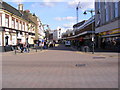
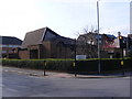
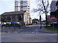
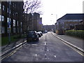
100 photos from this area
Area Information
Key information about the IG11 9XE including its size, population, and administrative classification.
- Area Type
- Postcode
- Area Size
- 1.4 hectares
- Population
- 1845
- Population Density
- 12585 people/km²
House Prices in IG11 9XE
80
Properties
£133,292
Average Sold Price
£38,995
Lowest Price
£244,800
Highest Price
Showing 80 properties
| Address | Type | Beds | Baths | Last Sale Price | Last Sale Date | |
|---|---|---|---|---|---|---|
| 34 Greenslade Road, Barking, IG11 9XE | Flat | - | - | £208,000 | Sep 2024 | |
| 36 Greenslade Road, Barking, IG11 9XE | Flat | 2 | - | £185,000 | Sep 2024 | |
| 5 Greenslade Road, Barking, IG11 9XE | Flat | 1 | 1 | £180,000 | Oct 2023 | |
| 32 Greenslade Road, Barking, IG11 9XE | Flat | - | - | £218,000 | Aug 2023 | |
| 78 Greenslade Road, Barking, IG11 9XE | Flat | 2 | 1 | £142,000 | Sep 2022 | |
| 14 Greenslade Road, Barking, IG11 9XE | Flat | 1 | 1 | £162,000 | Aug 2022 | |
| 49 Greenslade Road, Barking, IG11 9XE | Flat | - | - | £185,000 | Aug 2022 | |
| 51 Greenslade Road, Barking, IG11 9XE | Flat | 1 | 1 | £205,000 | Jul 2022 | |
| 3 Greenslade Road, Barking, IG11 9XE | Flat | - | - | £215,000 | May 2022 | |
| 54 Greenslade Road, Barking, IG11 9XE | Flat | 2 | 1 | £241,000 | May 2022 |
Page 1 of 8
Energy Efficiency in IG11 9XE
Amenities
Schools
| Rank | School | Type | Entry gender | Ages |
|---|
Explore more schools in this area
Go to Schools tabDemographics
Household Size
Family (3-5 people)
most common
Accommodation Type
Houses
most common
Tenure
50
majority
Ethnic Group
asian_total
most common
Religion
N/A
most common
Household Composition
N/A
most common
Age
47
median
Adults (30-64 years)
most common
Household Deprivation
N/A
with no deprivation
NS-SEC
23
in Lower managerial occupations
Explore more demographic insights in this area
Go to Demographics tabPlanning
Planning Constraints
- Flood RiskPremium
- Ramsar Wetland SitesPremium
- Area of Outstanding Natural BeautyPremium
- Protected Nature ReservePremium
- Protected WoodlandPremium