Area Overview for IG11 9UF
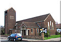
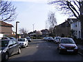
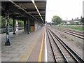
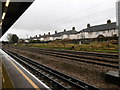
Photos of IG11 9UF


Area Information
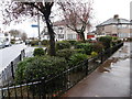
Living in IG11 9UF means being part of a small, tightly knit residential cluster in England, home to 1,795 residents. The area is defined by its compact nature, with homes predominantly in the form of single-family houses. The community is largely composed of adults aged 30–64, with a median age of 47, suggesting a stable, mature demographic. Daily life here is shaped by proximity to essential services, including five metro stations, multiple rail links, and nearby retail hubs. The area’s digital connectivity is strong, with a broadband score of 100 and mobile coverage rated 85, ensuring seamless internet access for work or leisure. While the population is modest, the presence of schools like Eastbury Community School and Faircross School adds to the area’s appeal for families. IG11 9UF is not a sprawling suburb but a focused neighbourhood where convenience and accessibility are prioritised, making it suitable for those seeking a balanced lifestyle with easy access to transport and amenities.
- Area Type
- Postcode
- Area Size
- Not available
- Population
- 1795
- Population Density
- 5284 people/km²
The property market in IG11 9UF is defined by a 68% home ownership rate, indicating that most residents live in properties they own. The area is dominated by houses, with no mention of flats or apartments, suggesting a focus on single-family homes. This makes IG11 9UF a low-density, residential area where properties are likely to be larger and more spread out than in urban centres. Given the small population and limited number of homes, the market is unlikely to be highly competitive, though buyers should consider the area’s compact size and the potential for limited new developments. The predominance of owner-occupied properties may also mean rental options are scarce, making this a less viable area for those seeking short-term lets.
House Prices in IG11 9UF
No properties found in this postcode.
Energy Efficiency in IG11 9UF
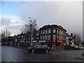
Residents of IG11 9UF have access to a range of amenities, including five retail outlets such as Co-op Faircross, Lidl Barking, and Tesco Barking, ensuring everyday shopping needs are met. The area’s transport links, including metro, rail, and ferry services, provide flexibility for commuting and leisure. Nearby, the Whipps Cross Bus Interchange adds to the connectivity, while the proximity to London City Airport offers international travel options. Though the data does not mention parks or leisure facilities, the presence of multiple transport and retail points suggests a practical, service-oriented lifestyle. The mix of shops, transport hubs, and nearby airports makes daily life efficient, though more details on recreational spaces would enhance understanding of the area’s character.
Amenities
Schools
Nearby schools include Eastbury Community School, a primary school with a Good Ofsted rating, and Faircross School, a special needs institution. These options cater to both mainstream and specialist educational requirements, offering families a range of choices. Eastbury’s Good rating suggests it provides a reliable foundation for younger children, while Faircross supports students with specific needs. The presence of both school types indicates the area serves a diverse population, including those requiring tailored educational support. However, the absence of secondary schools nearby means families may need to look further afield for older children’s education.
| Rank | School | Type | Entry gender | Ages |
|---|
Explore more schools in this area
Go to Schools tabDemographics
The population of IG11 9UF is 1,795, with a median age of 47, reflecting a community dominated by adults aged 30–64. Home ownership stands at 68%, indicating a majority of residents live in properties they own rather than rent. The area is characterised by houses, not flats or apartments, suggesting a preference for traditional family homes. The predominant ethnic group is Asian_total, which shapes the cultural fabric of the neighbourhood. While no specific data on deprivation is provided, the high home ownership rate and mature age profile may imply a relatively stable economic environment. However, the absence of detailed diversity metrics beyond the primary ethnic group means the full extent of the community’s composition remains partially unexplored.
Household Size
Accommodation Type
Tenure
Ethnic Group
Religion
Household Composition
Age
Household Deprivation
NS-SEC
Explore more demographic insights in this area
Go to Demographics tabPlanning
Planning Constraints
- Flood RiskPremium
- Ramsar Wetland SitesPremium
- Area of Outstanding Natural BeautyPremium
- Protected Nature ReservePremium
- Protected WoodlandPremium