Area Overview for IG11 9SF
Photos of IG11 9SF

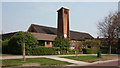
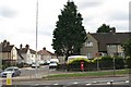

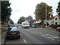
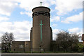


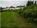


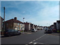
49 photos from this area
Area Information
Key information about the IG11 9SF including its size, population, and administrative classification.
- Area Type
- Postcode
- Area Size
- 8902 m²
- Population
- 1537
- Population Density
- 5770 people/km²
House Prices in IG11 9SF
16
Properties
£241,917
Average Sold Price
£81,500
Lowest Price
£400,000
Highest Price
Showing 16 properties
| Address | Type | Beds | Baths | Last Sale Price | Last Sale Date | |
|---|---|---|---|---|---|---|
| 102 Blake Avenue, Barking, IG11 9SF | house | 3 | - | £375,000 | Apr 2021 | |
| 81 Blake Avenue, Barking, IG11 9SF | house | - | - | £400,000 | May 2019 | |
| 100 Blake Avenue, Barking, IG11 9SF | house | - | - | £218,000 | Jul 2013 | |
| 116 Blake Avenue, Barking, IG11 9SF | house | - | - | £199,000 | Jun 2005 | |
| 112 Blake Avenue, Barking, IG11 9SF | house | - | - | £178,000 | Jan 2003 | |
| 75 Blake Avenue, Barking, IG11 9SF | house | - | - | £81,500 | Aug 2000 | |
| 114 Blake Avenue, Barking, IG11 9SF | Detached | 3 | 1 | - | - | |
| 106 Blake Avenue, Barking, IG11 9SF | house | - | - | - | - | |
| 108 Blake Avenue, Barking, IG11 9SF | Semi-detached | - | - | - | - | |
| 104 Blake Avenue, Barking, IG11 9SF | house | - | - | - | - |
Page 1 of 2
Energy Efficiency in IG11 9SF
Amenities
Schools
| Rank | School | Type | Entry gender | Ages |
|---|
Explore more schools in this area
Go to Schools tabDemographics
Household Size
Family (3-5 people)
most common
Accommodation Type
Houses
most common
Tenure
51
majority
Ethnic Group
White
most common
Religion
N/A
most common
Household Composition
N/A
most common
Age
47
median
Adults (30-64 years)
most common
Household Deprivation
N/A
with no deprivation
NS-SEC
21
in Lower managerial occupations
Explore more demographic insights in this area
Go to Demographics tabPlanning
Planning Constraints
- Flood RiskPremium
- Ramsar Wetland SitesPremium
- Area of Outstanding Natural BeautyPremium
- Protected Nature ReservePremium
- Protected WoodlandPremium