Area Overview for IG11 9QT
Photos of IG11 9QT
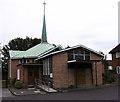
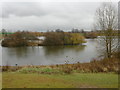
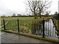
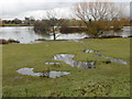
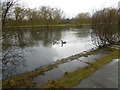

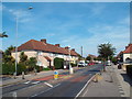
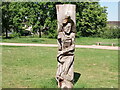
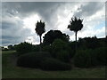
48 photos from this area
Area Information
Key information about the IG11 9QT including its size, population, and administrative classification.
- Area Type
- Postcode
- Area Size
- 3903 m²
- Population
- 1882
- Population Density
- 8140 people/km²
House Prices in IG11 9QT
20
Properties
£259,125
Average Sold Price
£165,000
Lowest Price
£455,000
Highest Price
Showing 20 properties
| Address | Type | Beds | Baths | Last Sale Price | Last Sale Date | |
|---|---|---|---|---|---|---|
| 1 Meadow Road, Barking, IG11 9QT | Terraced | 2 | 1 | £370,000 | Dec 2024 | |
| 15 Meadow Road, Barking, IG11 9QT | Terraced | 3 | 1 | £435,000 | Jun 2024 | |
| 17 Meadow Road, Barking, IG11 9QT | Terraced | 3 | - | £455,000 | Jul 2022 | |
| 19 Meadow Road, Barking, IG11 9QT | house | 1 | - | £250,000 | Dec 2019 | |
| 5 Meadow Road, Barking, IG11 9QT | Terraced | 2 | 2 | £235,000 | Jan 2015 | |
| 39 Meadow Road, Barking, IG11 9QT | Terraced | 2 | 1 | £208,000 | Jul 2014 | |
| 11 Meadow Road, Barking, IG11 9QT | house | 2 | - | £205,000 | Jun 2012 | |
| 35 Meadow Road, Barking, IG11 9QT | house | - | - | £205,500 | Aug 2007 | |
| 21 Meadow Road, Barking, IG11 9QT | Terraced | 4 | 2 | £186,000 | Dec 2006 | |
| 27 Meadow Road, Barking, IG11 9QT | Terraced | - | - | £199,995 | Sep 2006 |
Page 1 of 2
Energy Efficiency in IG11 9QT
Amenities
Schools
| Rank | School | Type | Entry gender | Ages |
|---|
Explore more schools in this area
Go to Schools tabDemographics
Household Size
Family (3-5 people)
most common
Accommodation Type
Houses
most common
Tenure
35
majority
Ethnic Group
White
most common
Religion
N/A
most common
Household Composition
N/A
most common
Age
47
median
Adults (30-64 years)
most common
Household Deprivation
N/A
with no deprivation
NS-SEC
20
in Lower managerial occupations
Explore more demographic insights in this area
Go to Demographics tabPlanning
Planning Constraints
- Flood RiskPremium
- Ramsar Wetland SitesPremium
- Area of Outstanding Natural BeautyPremium
- Protected Nature ReservePremium
- Protected WoodlandPremium