Area Overview for IG11 9QQ
Photos of IG11 9QQ
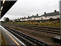
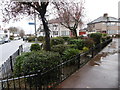
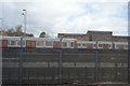
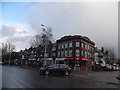
61 photos from this area
Area Information
Key information about the IG11 9QQ including its size, population, and administrative classification.
- Area Type
- Postcode
- Area Size
- 1.5 hectares
- Population
- 1879
- Population Density
- 11008 people/km²
House Prices in IG11 9QQ
43
Properties
£212,486
Average Sold Price
£27,280
Lowest Price
£393,000
Highest Price
Showing 43 properties
| Address | Type | Beds | Baths | Last Sale Price | Last Sale Date | |
|---|---|---|---|---|---|---|
| 104 Dawson Avenue, Barking, IG11 9QQ | house | 2 | 1 | £360,000 | Mar 2025 | |
| 96 Dawson Avenue, Barking, IG11 9QQ | Terraced | 2 | 1 | £390,000 | Oct 2024 | |
| 33 Dawson Avenue, Barking, IG11 9QQ | Terraced | 2 | 1 | £345,000 | Jun 2024 | |
| 118 Dawson Avenue, Barking, IG11 9QQ | house | - | - | £355,000 | Oct 2022 | |
| 78 Dawson Avenue, Barking, IG11 9QQ | Semi-detached | 2 | 1 | £393,000 | Jul 2021 | |
| 45 Dawson Avenue, Barking, IG11 9QQ | Terraced | 2 | 1 | £355,000 | Mar 2021 | |
| 47 Dawson Avenue, Barking, IG11 9QQ | Terraced | 2 | 1 | £311,500 | Nov 2018 | |
| 98 Dawson Avenue, Barking, IG11 9QQ | Terraced | - | - | £190,000 | Jul 2008 | |
| 35 Dawson Avenue, Barking, IG11 9QQ | house | 2 | - | £210,000 | Feb 2008 | |
| 120 Dawson Avenue, Barking, IG11 9QQ | house | 2 | 1 | £165,000 | Nov 2005 |
Page 1 of 5
Energy Efficiency in IG11 9QQ
Amenities
Schools
| Rank | School | Type | Entry gender | Ages |
|---|
Explore more schools in this area
Go to Schools tabDemographics
Household Size
Family (3-5 people)
most common
Accommodation Type
Houses
most common
Tenure
33
majority
Ethnic Group
White
most common
Religion
N/A
most common
Household Composition
N/A
most common
Age
47
median
Adults (30-64 years)
most common
Household Deprivation
N/A
with no deprivation
NS-SEC
19
in Lower managerial occupations
Explore more demographic insights in this area
Go to Demographics tabPlanning
Planning Constraints
- Flood RiskPremium
- Ramsar Wetland SitesPremium
- Area of Outstanding Natural BeautyPremium
- Protected Nature ReservePremium
- Protected WoodlandPremium