Area Overview for IG11 9DF
Photos of IG11 9DF
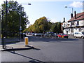
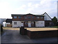
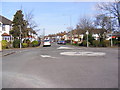
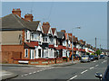
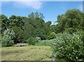
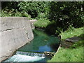
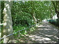
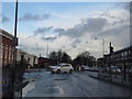
72 photos from this area
Area Information
Key information about the IG11 9DF including its size, population, and administrative classification.
- Area Type
- Postcode
- Area Size
- 5086 m²
- Population
- 2378
- Population Density
- 10237 people/km²
House Prices in IG11 9DF
10
Properties
£454,000
Average Sold Price
£295,000
Lowest Price
£635,000
Highest Price
Showing 10 properties
| Address | Type | Beds | Baths | Last Sale Price | Last Sale Date | |
|---|---|---|---|---|---|---|
| 487 Longbridge Road, Barking, IG11 9DF | house | 3 | 1 | £555,000 | Sep 2024 | |
| 489 Longbridge Road, Barking, IG11 9DF | Semi-detached | 3 | 1 | £635,000 | Oct 2023 | |
| 481 Longbridge Road, Barking, IG11 9DF | house | 5 | 2 | £600,000 | Jun 2021 | |
| 473 Longbridge Road, Barking, IG11 9DF | Semi-detached | 3 | 1 | £475,000 | Jul 2018 | |
| 477 Longbridge Road, Barking, IG11 9DF | Semi-detached | 3 | 1 | £455,000 | Mar 2018 | |
| 479 Longbridge Road, Barking, IG11 9DF | Semi-detached | 3 | 1 | £385,000 | Jun 2015 | |
| 483 Longbridge Road, Barking, IG11 9DF | house | - | - | £361,000 | May 2015 | |
| 471 Longbridge Road, Barking, IG11 9DF | Semi-detached | 3 | 2 | £325,000 | Dec 2010 | |
| 485 Longbridge Road, Barking, IG11 9DF | house | - | - | £295,000 | Dec 2010 | |
| 475 Longbridge Road, Barking, IG11 9DF | Semi-detached | - | - | - | - |
Energy Efficiency in IG11 9DF
Amenities
Schools
| Rank | School | Type | Entry gender | Ages |
|---|
Explore more schools in this area
Go to Schools tabDemographics
Household Size
Family (3-5 people)
most common
Accommodation Type
Houses
most common
Tenure
75
majority
Ethnic Group
asian_total
most common
Religion
N/A
most common
Household Composition
N/A
most common
Age
47
median
Adults (30-64 years)
most common
Household Deprivation
N/A
with no deprivation
NS-SEC
28
in Lower managerial occupations
Explore more demographic insights in this area
Go to Demographics tabPlanning
Planning Constraints
- Flood RiskPremium
- Ramsar Wetland SitesPremium
- Area of Outstanding Natural BeautyPremium
- Protected Nature ReservePremium
- Protected WoodlandPremium