Area Overview for IG11 9DA
Photos of IG11 9DA

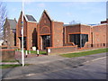
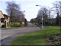


24 photos from this area
Area Information
Key information about the IG11 9DA including its size, population, and administrative classification.
- Area Type
- Postcode
- Area Size
- 5286 m²
- Population
- 2378
- Population Density
- 10237 people/km²
House Prices in IG11 9DA
12
Properties
£272,944
Average Sold Price
£60,000
Lowest Price
£610,000
Highest Price
Showing 12 properties
| Address | Type | Beds | Baths | Last Sale Price | Last Sale Date | |
|---|---|---|---|---|---|---|
| 543 Longbridge Road, Barking, IG11 9DA | Semi-detached | 4 | 1 | £500,000 | Aug 2024 | |
| 549 Longbridge Road, Barking, IG11 9DA | Semi-detached | 3 | 1 | £610,000 | Jan 2021 | |
| 551 Longbridge Road, Barking, IG11 9DA | house | - | - | £225,000 | Nov 2010 | |
| 539 Longbridge Road, Barking, IG11 9DA | Block of Flats | - | 1 | £249,999 | Dec 2007 | |
| 559 Longbridge Road, Barking, IG11 9DA | Semi-detached | - | - | £230,000 | Dec 2006 | |
| 553 Longbridge Road, Barking, IG11 9DA | Terraced | 3 | 2 | £232,000 | Nov 2005 | |
| 545 Longbridge Road, Barking, IG11 9DA | house | - | - | £212,000 | Nov 2003 | |
| 557 Longbridge Road, Barking, IG11 9DA | Semi-detached | - | - | £137,500 | Oct 2000 | |
| 555 Longbridge Road, Barking, IG11 9DA | house | - | - | £60,000 | Apr 1997 | |
| 541 Longbridge Road, Barking, IG11 9DA | house | 3 | 1 | - | - |
Page 1 of 2
Energy Efficiency in IG11 9DA
Amenities
Schools
| Rank | School | Type | Entry gender | Ages |
|---|
Explore more schools in this area
Go to Schools tabDemographics
Household Size
Family (3-5 people)
most common
Accommodation Type
Houses
most common
Tenure
75
majority
Ethnic Group
asian_total
most common
Religion
N/A
most common
Household Composition
N/A
most common
Age
47
median
Adults (30-64 years)
most common
Household Deprivation
N/A
with no deprivation
NS-SEC
28
in Lower managerial occupations
Explore more demographic insights in this area
Go to Demographics tabPlanning
Planning Constraints
- Flood RiskPremium
- Ramsar Wetland SitesPremium
- Area of Outstanding Natural BeautyPremium
- Protected Nature ReservePremium
- Protected WoodlandPremium