Area Overview for IG11 9BD
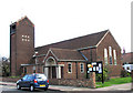
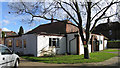
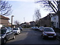
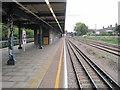
Photos of IG11 9BD

Area Information
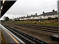
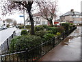
Living in IG11 9BD means being part of a small, tightly knit residential cluster in England with a population of 2,607. This area is defined by its compact size and proximity to a range of practical amenities, making it accessible for daily life. The community is predominantly composed of adults aged 30–64, reflecting a mature demographic profile. While the area does not sprawl, its strategic location near multiple transport hubs, including rail, metro, and ferry services, ensures connectivity to larger urban centres. Residents benefit from a mix of local retail options, such as Co-op Faircross and Tesco Barking, alongside easy access to London City Airport. The housing stock here is largely composed of individual homes, which may appeal to those seeking a more private, settled lifestyle. While the area lacks natural conservation designations, its low flood risk and absence of planning constraints make it a pragmatic choice for buyers prioritising safety and ease of development.
- Area Type
- Postcode
- Area Size
- Not available
- Population
- 2607
- Population Density
- 9631 people/km²
The property market in IG11 9BD is characterised by a 61% home ownership rate, suggesting a mix of owner-occupied and rental properties. The accommodation type is primarily houses, which may indicate a focus on family-friendly or larger homes. Given the area’s small size and the prevalence of individual dwellings, the housing stock is likely limited in volume, potentially making it a competitive market for buyers. The lack of planning constraints or protected designations may offer flexibility for property development or renovation. However, the relatively high proportion of owner-occupied homes could mean fewer rental options, which might be a consideration for those seeking short-term or flexible housing solutions. Buyers should also factor in the area’s proximity to transport links, which may enhance its appeal for commuters or those prioritising connectivity.
House Prices in IG11 9BD
No properties found in this postcode.
Energy Efficiency in IG11 9BD
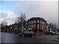
Residents of IG11 9BD have access to a range of amenities that support daily life. Local retail options include Co-op Faircross, Tesco Barking, and Co-op Porters, providing essential shopping and convenience services. The area’s transport network, with multiple metro, rail, and ferry services, ensures easy access to broader urban amenities. Nearby, the Woolwich Ferry North Pier and Barrier Gardens Pier offer water-based connectivity, while London City Airport is within reach for air travel. Though the area itself is small, its proximity to larger hubs means residents can enjoy the vibrancy of surrounding regions. The mix of retail, transport, and travel options creates a practical lifestyle, balancing local convenience with broader opportunities.
Amenities
Schools
| Rank | School | Type | Entry gender | Ages |
|---|
Explore more schools in this area
Go to Schools tabDemographics
The community in IG11 9BD is predominantly composed of adults aged 30–64, with a median age of 47. This suggests a stable, established population, likely with long-term ties to the area. Home ownership rates stand at 61%, indicating a mix of owner-occupied properties and rental units. The accommodation type is largely houses, which may reflect a preference for family homes or larger living spaces. The predominant ethnic group is Asian_total, highlighting the area’s cultural diversity. While specific data on deprivation is not provided, the age profile and ownership figures suggest a community that balances generational stability with a degree of economic diversity. The absence of protected natural areas or planning constraints may also contribute to a practical, low-maintenance lifestyle for residents.
Household Size
Accommodation Type
Tenure
Ethnic Group
Religion
Household Composition
Age
Household Deprivation
NS-SEC
Explore more demographic insights in this area
Go to Demographics tabPlanning
Planning Constraints
- Flood RiskPremium
- Ramsar Wetland SitesPremium
- Area of Outstanding Natural BeautyPremium
- Protected Nature ReservePremium
- Protected WoodlandPremium