Area Overview for IG11 9AJ
Photos of IG11 9AJ
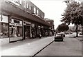
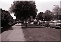
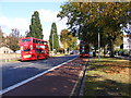
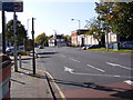
72 photos from this area
Area Information
Key information about the IG11 9AJ including its size, population, and administrative classification.
- Area Type
- Postcode
- Area Size
- 1.1 hectares
- Population
- 2237
- Population Density
- 11621 people/km²
House Prices in IG11 9AJ
39
Properties
£308,318
Average Sold Price
£96,000
Lowest Price
£565,000
Highest Price
Showing 39 properties
| Address | Type | Beds | Baths | Last Sale Price | Last Sale Date | |
|---|---|---|---|---|---|---|
| 86 Sandringham Road, Barking, IG11 9AJ | Terraced | 3 | 1 | £550,000 | Sep 2025 | |
| 64 Sandringham Road, Barking, IG11 9AJ | Terraced | 3 | 1 | £485,000 | Aug 2023 | |
| 58 Sandringham Road, Barking, IG11 9AJ | house | - | - | £292,089 | Apr 2023 | |
| 52 Sandringham Road, Barking, IG11 9AJ | house | 4 | 2 | £560,000 | Jul 2022 | |
| 30 Sandringham Road, Barking, IG11 9AJ | house | - | - | £565,000 | Feb 2022 | |
| 92 Sandringham Road, Barking, IG11 9AJ | Terraced | 4 | 1 | £470,000 | Sep 2021 | |
| 98 Sandringham Road, Barking, IG11 9AJ | Terraced | 4 | - | £445,000 | Nov 2016 | |
| 70 Sandringham Road, Barking, IG11 9AJ | Terraced | 3 | 1 | £420,000 | Feb 2016 | |
| 60 Sandringham Road, Barking, IG11 9AJ | Terraced | 3 | 1 | £325,000 | Feb 2015 | |
| 48 Sandringham Road, Barking, IG11 9AJ | Terraced | 4 | 2 | £350,000 | Sep 2014 |
Page 1 of 4
Energy Efficiency in IG11 9AJ
Amenities
Schools
| Rank | School | Type | Entry gender | Ages |
|---|
Explore more schools in this area
Go to Schools tabDemographics
Household Size
Family (3-5 people)
most common
Accommodation Type
Houses
most common
Tenure
65
majority
Ethnic Group
asian_total
most common
Religion
N/A
most common
Household Composition
N/A
most common
Age
47
median
Adults (30-64 years)
most common
Household Deprivation
N/A
with no deprivation
NS-SEC
27
in Lower managerial occupations
Explore more demographic insights in this area
Go to Demographics tabPlanning
Planning Constraints
- Flood RiskPremium
- Ramsar Wetland SitesPremium
- Area of Outstanding Natural BeautyPremium
- Protected Nature ReservePremium
- Protected WoodlandPremium