Area Overview for IG11 9AF
Photos of IG11 9AF
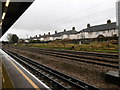
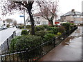
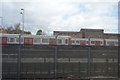
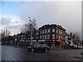
61 photos from this area
Area Information
Key information about the IG11 9AF including its size, population, and administrative classification.
- Area Type
- Postcode
- Area Size
- 9402 m²
- Population
- 2096
- Population Density
- 10454 people/km²
House Prices in IG11 9AF
33
Properties
£317,788
Average Sold Price
£79,000
Lowest Price
£610,000
Highest Price
Showing 33 properties
| Address | Type | Beds | Baths | Last Sale Price | Last Sale Date | |
|---|---|---|---|---|---|---|
| 103 Sandringham Road, Barking, IG11 9AF | Terraced | 3 | 1 | £535,000 | Mar 2025 | |
| 57 Sandringham Road, Barking, IG11 9AF | Terraced | 3 | 1 | £580,000 | Dec 2024 | |
| 81 Sandringham Road, Barking, IG11 9AF | Retail | 5 | 2 | £610,000 | Sep 2022 | |
| 61 Sandringham Road, Barking, IG11 9AF | Terraced | 5 | 2 | £600,000 | Feb 2020 | |
| 91 Sandringham Road, Barking, IG11 9AF | Terraced | 4 | 3 | £530,000 | Dec 2019 | |
| 47 Sandringham Road, Barking, IG11 9AF | Terraced | 3 | 1 | £390,000 | Mar 2019 | |
| 77 Sandringham Road, Barking, IG11 9AF | Terraced | 3 | - | £422,000 | Jul 2017 | |
| 95 Sandringham Road, Barking, IG11 9AF | Terraced | 3 | - | £530,000 | Mar 2017 | |
| 51 Sandringham Road, Barking, IG11 9AF | house | 3 | - | £116,561 | Sep 2014 | |
| 53 Sandringham Road, Barking, IG11 9AF | Semi-detached | 4 | - | £385,000 | Mar 2014 |
Page 1 of 4
Energy Efficiency in IG11 9AF
Amenities
Schools
| Rank | School | Type | Entry gender | Ages |
|---|
Explore more schools in this area
Go to Schools tabDemographics
Household Size
Family (3-5 people)
most common
Accommodation Type
Houses
most common
Tenure
84
majority
Ethnic Group
asian_total
most common
Religion
N/A
most common
Household Composition
N/A
most common
Age
47
median
Adults (30-64 years)
most common
Household Deprivation
N/A
with no deprivation
NS-SEC
32
in Lower managerial occupations
Explore more demographic insights in this area
Go to Demographics tabPlanning
Planning Constraints
- Flood RiskPremium
- Ramsar Wetland SitesPremium
- Area of Outstanding Natural BeautyPremium
- Protected Nature ReservePremium
- Protected WoodlandPremium