Area Overview for IG11 8PZ
Photos of IG11 8PZ
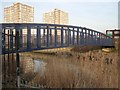
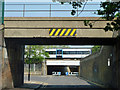
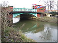
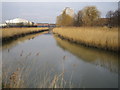
93 photos from this area
Area Information
Key information about the IG11 8PZ including its size, population, and administrative classification.
- Area Type
- Postcode
- Area Size
- 1.7 hectares
- Population
- 2347
- Population Density
- 16702 people/km²
House Prices in IG11 8PZ
72
Properties
£223,314
Average Sold Price
£55,000
Lowest Price
£710,000
Highest Price
Showing 72 properties
| Address | Type | Beds | Baths | Last Sale Price | Last Sale Date | |
|---|---|---|---|---|---|---|
| 78 Victoria Road, Barking, IG11 8PZ | house | - | - | £350,000 | May 2025 | |
| 139 Victoria Road, Barking, IG11 8PZ | Terraced | 2 | 1 | £342,000 | Dec 2023 | |
| 96 Victoria Road, Barking, IG11 8PZ | house | - | - | £350,000 | Feb 2022 | |
| 82 Victoria Road, Barking, IG11 8PZ | Terraced | 2 | 1 | £310,000 | Nov 2021 | |
| 111 Victoria Road, Barking, IG11 8PZ | house | 2 | 1 | £300,000 | Sep 2021 | |
| 98 Victoria Road, Barking, IG11 8PZ | Terraced | 3 | 1 | £335,000 | Mar 2021 | |
| 91 Victoria Road, Barking, IG11 8PZ | Terraced | 2 | 1 | £360,000 | Feb 2021 | |
| 155 Victoria Road, Barking, IG11 8PZ | house | - | - | £255,000 | Aug 2020 | |
| 90 Victoria Road, Barking, IG11 8PZ | Terraced | 2 | 1 | £250,000 | Jun 2020 | |
| 117 Victoria Road, Barking, IG11 8PZ | Terraced | 1 | 1 | £710,000 | Jan 2019 |
Page 1 of 8
Energy Efficiency in IG11 8PZ
Amenities
Schools
| Rank | School | Type | Entry gender | Ages |
|---|
Explore more schools in this area
Go to Schools tabDemographics
Household Size
Family (3-5 people)
most common
Accommodation Type
Flats
most common
Tenure
29
majority
Ethnic Group
asian_total
most common
Religion
N/A
most common
Household Composition
N/A
most common
Age
22
median
Adults (30-64 years)
most common
Household Deprivation
N/A
with no deprivation
NS-SEC
18
in Lower managerial occupations
Explore more demographic insights in this area
Go to Demographics tabPlanning
Planning Constraints
- Flood RiskPremium
- Ramsar Wetland SitesPremium
- Area of Outstanding Natural BeautyPremium
- Protected Nature ReservePremium
- Protected WoodlandPremium