Area Overview for IG11 8PH
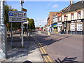
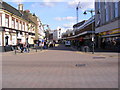
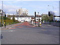
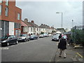
Photos of IG11 8PH


Area Information
Living in IG11 8PH means being part of a small, tightly knit residential cluster in east London, with a population of just over 2,300 people. The area is defined by its proximity to transport hubs and retail centres, making it practical for commuters and families. While the median age is 22, the most common age range is 30–64, suggesting a balance between younger residents and more established households. The area’s character is shaped by its flat-based housing stock, which reflects a rental market dominance. Nearby, the Al Madina School for Girls offers an independent education option, and the postcode’s location ensures easy access to rail, metro, and ferry services. Digital connectivity is strong, with broadband and mobile scores in the good to excellent range, supporting remote work and daily connectivity. However, the area’s safety profile shows a medium crime risk, requiring standard precautions. Despite this, IG11 8PH offers a blend of practicality and accessibility, ideal for those prioritising transport links and proximity to amenities.
- Area Type
- Postcode
- Area Size
- Not available
- Population
- 2347
- Population Density
- 16702 people/km²
The property market in IG11 8PH is characterised by a low home ownership rate of 29%, indicating that the majority of residents are renters. Flats dominate the accommodation stock, which is typical for smaller residential areas with limited land availability. This suggests a market skewed towards rental properties rather than owner-occupied homes, potentially limiting long-term investment opportunities for buyers. The small size of the area means housing options are constrained, and the immediate surroundings may offer similar dynamics. For those considering purchase, the flat-based stock implies a focus on affordability over property value growth. However, the proximity to transport links and amenities could offset this, making the area attractive for commuters or those prioritising convenience over capital appreciation. Buyers should consider the rental market’s saturation when evaluating property potential.
House Prices in IG11 8PH
No properties found in this postcode.
Energy Efficiency in IG11 8PH
Residents of IG11 8PH have access to a range of practical amenities, including five retail outlets such as Asda Barking and Tesco Barking, which cater to everyday shopping needs. The area’s ferry services, including Woolwich Ferry North Pier, offer easy access to nearby districts, while the proximity to London City Airport provides travel convenience. The Whipps Cross Bus Interchange serves as a central hub for regional travel. Though the area lacks extensive green spaces or leisure facilities, its transport links and retail options ensure a functional lifestyle. The presence of multiple rail and metro stations means daily commutes are efficient, and the digital connectivity supports modern living. While the area’s small size limits diversity in amenities, its strategic location and accessibility make it a pragmatic choice for those prioritising convenience over expansive recreational options.
Amenities
Schools
The nearest school to IG11 8PH is Al Madina School for Girls, an independent institution with an Ofsted rating of ‘good’. This single school option highlights the limited range of educational choices in the area, though its independent status may appeal to families seeking alternative education models. The absence of state schools or other educational institutions nearby means that families must rely on this one option or travel to surrounding areas. For those prioritising school diversity, this could be a limitation. However, the ‘good’ Ofsted rating suggests a satisfactory standard of education, which may be a deciding factor for some households. The school’s presence adds to the area’s appeal for families, though the lack of additional schools underscores the need for careful planning when considering relocation.
| Rank | School | Type | Entry gender | Ages |
|---|
Explore more schools in this area
Go to Schools tabDemographics
The community in IG11 8PH is predominantly composed of adults aged 30–64, though the median age is 22, indicating a younger demographic pull. Home ownership is low at 29%, with flats being the primary accommodation type. This suggests a rental-heavy market, likely influenced by the area’s small size and limited housing stock. The predominant ethnic group is Asian, which shapes the cultural landscape and community dynamics. With a population of 2,347, the area is compact, fostering a close-knit environment. However, the data does not indicate deprivation levels, so it is unclear how this affects quality of life. The mix of age groups and housing types creates a diverse but potentially transient population, where families and younger individuals coexist. The absence of specific deprivation metrics means that assumptions about socio-economic challenges must be avoided.
Household Size
Accommodation Type
Tenure
Ethnic Group
Religion
Household Composition
Age
Household Deprivation
NS-SEC
Explore more demographic insights in this area
Go to Demographics tabPlanning
Planning Constraints
- Flood RiskPremium
- Ramsar Wetland SitesPremium
- Area of Outstanding Natural BeautyPremium
- Protected Nature ReservePremium
- Protected WoodlandPremium