Area Overview for IG11 8AH
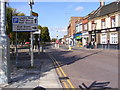
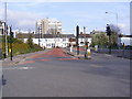
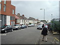
Photos of IG11 8AH


Area Information
IG11 8AH is a small, tightly knit residential postcode in England with a population of 2,908. It is a compact cluster of homes, predominantly flats, serving a community where adults aged 30–64 make up the largest demographic. The area’s character is shaped by its proximity to transport hubs and retail centres, offering a balance of convenience and quiet living. Residents benefit from easy access to multiple rail and metro stations, including Barking and Ilford, which connect to London’s broader transport network. The presence of Northbury Primary School and Northbury Infants’ School ensures families have access to quality education nearby. While the area lacks natural landscapes or protected sites, its practical layout and connectivity make it appealing for commuters. The community is diverse, with Asian residents forming the predominant ethnic group, contributing to a culturally rich environment. Daily life here revolves around local shops, public transport, and the proximity to London City Airport, making it a practical choice for those prioritising accessibility over scenic surroundings.
- Area Type
- Postcode
- Area Size
- Not available
- Population
- 2908
- Population Density
- 14540 people/km²
The property market in IG11 8AH is characterised by a low home ownership rate of 27%, suggesting that the majority of housing stock is rented. The accommodation type is predominantly flats, which are typically found in purpose-built blocks or converted buildings. This indicates a limited variety of property types, with fewer detached or semi-detached homes available. The small size of the postcode means the immediate surrounding area is likely to have similar housing stock, limiting options for buyers seeking larger properties. For those considering purchase, the market may be more competitive for flats, with prices potentially influenced by proximity to transport links and schools. However, the low home ownership rate could also mean a higher proportion of rental properties, which may affect long-term investment potential. Buyers should assess the availability of flats and consider the area’s practical advantages, such as transport connectivity, over larger living spaces.
House Prices in IG11 8AH
No properties found in this postcode.
Energy Efficiency in IG11 8AH
Living in IG11 8AH offers a blend of practicality and convenience, with a range of amenities within reach. Residents can access major retail outlets such as Asda, Tesco, and Iceland, ensuring daily shopping needs are met. The area’s transport links, including rail, metro, and ferry services, provide flexibility for commuting or leisure travel. The Woolwich Ferry services, including Woolwich Arsenal Pier, offer scenic routes across the Thames, adding a leisurely dimension to daily life. The presence of multiple transport hubs, such as Barking Station and Whipps Cross Bus Interchange, ensures efficient movement within and beyond the area. While the postcode lacks natural parks or green spaces, its proximity to urban amenities and transport networks makes it ideal for those prioritising accessibility over rural settings. The mix of retail, transport, and ferry options contributes to a dynamic lifestyle, supporting both professional and personal needs.
Amenities
Schools
Residents of IG11 8AH have access to two primary schools: Northbury Primary School, which holds a ‘good’ Ofsted rating, and Northbury Infants’ School. These institutions serve the local community, providing education for children from early years through to primary level. The presence of two primary schools within the area ensures that families have options for their children’s schooling, reducing the need for long commutes. Northbury Primary School’s ‘good’ rating suggests it meets or exceeds national standards in teaching and pupil outcomes. However, the absence of secondary schools in the immediate vicinity means students may need to travel to nearby areas for further education. The concentration of primary schools reflects the area’s focus on family-oriented living, with schools playing a central role in the local infrastructure.
| Rank | School | Type | Entry gender | Ages |
|---|
Explore more schools in this area
Go to Schools tabDemographics
The population of IG11 8AH is 2,908, with a median age of 47. The majority of residents are adults aged 30–64, reflecting a community of working-age individuals and families. Home ownership is relatively low at 27%, indicating that most residents rent their homes. The accommodation type is predominantly flats, suggesting a mix of purpose-built housing and converted properties. The area’s demographic profile is shaped by its Asian_total population, which forms the largest ethnic group. This diversity influences local culture and community dynamics. The age distribution suggests a stable population with fewer young children or retirees, which may impact local services and amenities. The lower home ownership rate could indicate a rental market dominated by private landlords or housing associations, which may affect property availability and affordability for buyers.
Household Size
Accommodation Type
Tenure
Ethnic Group
Religion
Household Composition
Age
Household Deprivation
NS-SEC
Explore more demographic insights in this area
Go to Demographics tabPlanning
Planning Constraints
- Flood RiskPremium
- Ramsar Wetland SitesPremium
- Area of Outstanding Natural BeautyPremium
- Protected Nature ReservePremium
- Protected WoodlandPremium