Area Overview for IG11 7XN
Photos of IG11 7XN


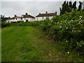


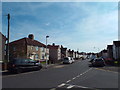
49 photos from this area
Area Information
Key information about the IG11 7XN including its size, population, and administrative classification.
- Area Type
- Postcode
- Area Size
- 1.7 hectares
- Population
- 2368
- Population Density
- 11858 people/km²
House Prices in IG11 7XN
38
Properties
£248,409
Average Sold Price
£78,000
Lowest Price
£435,000
Highest Price
Showing 38 properties
| Address | Type | Beds | Baths | Last Sale Price | Last Sale Date | |
|---|---|---|---|---|---|---|
| 31 Alfreds Gardens, Barking, IG11 7XN | Semi-detached | 3 | 1 | £410,000 | Jul 2025 | |
| 8 Alfreds Gardens, Barking, IG11 7XN | Flat | - | - | £181,000 | Dec 2024 | |
| 36 Alfreds Gardens, Barking, IG11 7XN | Terraced | 3 | 1 | £435,000 | Sep 2024 | |
| 28 Alfreds Gardens, Barking, IG11 7XN | Terraced | 3 | 1 | £420,000 | Aug 2024 | |
| 18 Alfreds Gardens, Barking, IG11 7XN | Flat | 1 | 1 | £175,000 | Nov 2023 | |
| 35 Alfreds Gardens, Barking, IG11 7XN | house | - | - | £385,000 | Sep 2023 | |
| 3 Alfreds Gardens, Barking, IG11 7XN | Flat | 1 | 1 | £182,000 | Sep 2020 | |
| 29 Alfreds Gardens, Barking, IG11 7XN | Terraced | 3 | 1 | £360,000 | Aug 2018 | |
| 24 Alfreds Gardens, Barking, IG11 7XN | Terraced | 3 | 1 | £310,000 | Jun 2018 | |
| 32 Alfreds Gardens, Barking, IG11 7XN | Semi-detached | 3 | - | £375,000 | Apr 2018 |
Page 1 of 4
Energy Efficiency in IG11 7XN
Amenities
Schools
| Rank | School | Type | Entry gender | Ages |
|---|
Explore more schools in this area
Go to Schools tabDemographics
Household Size
Family (3-5 people)
most common
Accommodation Type
Houses
most common
Tenure
42
majority
Ethnic Group
White
most common
Religion
N/A
most common
Household Composition
N/A
most common
Age
47
median
Adults (30-64 years)
most common
Household Deprivation
N/A
with no deprivation
NS-SEC
21
in Lower managerial occupations
Explore more demographic insights in this area
Go to Demographics tabPlanning
Planning Constraints
- Flood RiskPremium
- Ramsar Wetland SitesPremium
- Area of Outstanding Natural BeautyPremium
- Protected Nature ReservePremium
- Protected WoodlandPremium