Area Overview for IG11 0JL
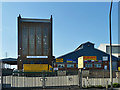
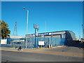
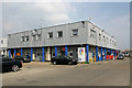
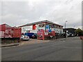
Photos of IG11 0JL


Area Information
Living in IG11 0JL means being part of a small, tightly knit residential cluster in England, home to 1,821 people. The area is characterised by its proximity to transport hubs and retail centres, making it practical for daily life. With a median age of 22, the community is young but skewed toward adults aged 30–64, suggesting a mix of established residents and newer arrivals. The area’s housing stock is dominated by houses, reflecting a quieter, more traditional neighbourhood feel. Residents benefit from excellent broadband connectivity, rated 98 out of 100, and good mobile coverage, rated 85. Nearby, rail stations like Barking Riverside and Barking offer easy access to London’s transport network, while shops such as Tesco Barking and Co-op INDF provide convenience. Though small, the area’s layout ensures a balance between residential tranquillity and urban accessibility, appealing to those seeking practical living without sacrificing proximity to amenities.
- Area Type
- Postcode
- Area Size
- Not available
- Population
- 1821
- Population Density
- 2582 people/km²
The property market in IG11 0JL is shaped by its 37% home ownership rate, which points to a rental-dominated landscape. The area’s housing stock consists primarily of houses, rather than flats or apartments, reflecting a preference for standalone properties. This makes the area more appealing to families or individuals seeking space and privacy. However, the limited population of 1,821 and the focus on houses suggest a constrained market, with fewer properties available for purchase compared to larger urban areas. Buyers should consider the competitive nature of the rental market and the potential for limited new developments. The proximity to transport hubs like Barking Station and Barking Riverside Station may enhance property desirability, particularly for commuters. For those seeking ownership, the small size of the area means exploring nearby postcode clusters could be necessary to find a wider range of options.
House Prices in IG11 0JL
Showing 2 properties
| Address | Type | Beds | Baths | Last Sale Price | Last Sale Date | |
|---|---|---|---|---|---|---|
| Flat 21, Ferdinand House, 18 Fielders Crescent, Barking, IG11 0JL | Flat | 1 | - | - | - | |
| Flat 6, Ferdinand House, 18 Fielders Crescent, Barking, IG11 0JL | Flat | 1 | - | - | - |
Energy Efficiency in IG11 0JL
Residents of IG11 0JL have access to a range of amenities within walking or short transit distance. Retail options include major chains like Tesco Barking and The Southern Co-operative Co, ensuring everyday shopping needs are met. The area’s transport network is a standout feature, with rail stations such as Barking Riverside and Dagenham Dock offering links to London’s suburbs and centres. Metro stations like Upney and Beckton provide additional connectivity, while ferry services from Woolwich Arsenal Pier offer alternative routes across the Thames. London City Airport is nearby, adding to the area’s appeal for those with travel or work-related needs. The mix of retail, transport, and transit options creates a practical lifestyle, where daily errands and commuting are efficient. The presence of multiple stations also suggests the area is well-integrated into regional transport systems, enhancing its accessibility.
Amenities
Schools
| Rank | School | Type | Entry gender | Ages |
|---|
Explore more schools in this area
Go to Schools tabDemographics
The community in IG11 0JL is predominantly composed of adults aged 30–64, with a median age of 22, indicating a youthful presence alongside a mature population. Home ownership stands at 37%, suggesting a rental market dominates, with many residents likely to be tenants. The area’s accommodation is largely houses, rather than flats or apartments, which may appeal to families or those preferring standalone properties. The predominant ethnic group is Black_total, reflecting a culturally diverse population. While specific deprivation data is not provided, the mix of age groups and housing types implies a range of socioeconomic profiles. The presence of multiple retail outlets and transport links suggests accessibility to services, though the lower home ownership rate may indicate higher demand for rental properties. This dynamic shapes a community where convenience and affordability are key considerations for residents.
Household Size
Accommodation Type
Tenure
Ethnic Group
Religion
Household Composition
Age
Household Deprivation
NS-SEC
Explore more demographic insights in this area
Go to Demographics tabPlanning
Planning Constraints
- Flood RiskPremium
- Ramsar Wetland SitesPremium
- Area of Outstanding Natural BeautyPremium
- Protected Nature ReservePremium
- Protected WoodlandPremium