Area Overview for IG11 0GH
Photos of IG11 0GH


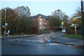
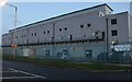


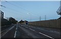
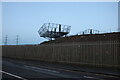
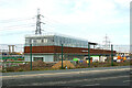
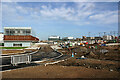
53 photos from this area
Area Information
Key information about the IG11 0GH including its size, population, and administrative classification.
- Area Type
- Postcode
- Area Size
- 3.3 hectares
- Population
- 2461
- Population Density
- 4082 people/km²
House Prices in IG11 0GH
41
Properties
£191,504
Average Sold Price
£85,000
Lowest Price
£365,000
Highest Price
Showing 41 properties
| Address | Type | Beds | Baths | Last Sale Price | Last Sale Date | |
|---|---|---|---|---|---|---|
| 5 Atlantis Close, Barking, IG11 0GH | house | - | - | £315,000 | May 2021 | |
| 19 Atlantis Close, Barking, IG11 0GH | Semi-detached | 2 | 2 | £313,000 | Sep 2020 | |
| 8 Atlantis Close, Barking, IG11 0GH | Flat | - | - | £172,000 | Feb 2020 | |
| 31 Atlantis Close, Barking, IG11 0GH | Terraced | 3 | - | £365,000 | Oct 2019 | |
| 28 Atlantis Close, Barking, IG11 0GH | Terraced | 2 | - | £290,000 | Dec 2016 | |
| 17 Atlantis Close, Barking, IG11 0GH | Semi-detached | 2 | 1 | £234,000 | Jan 2016 | |
| 9 Atlantis Close, Barking, IG11 0GH | Terraced | 2 | 1 | £258,200 | Sep 2015 | |
| 26 Atlantis Close, Barking, IG11 0GH | house | - | - | £225,000 | Apr 2015 | |
| 27 Atlantis Close, Barking, IG11 0GH | Terraced | 2 | 1 | £193,000 | Mar 2015 | |
| 25 Atlantis Close, Barking, IG11 0GH | house | 3 | - | £267,000 | Jan 2015 |
Page 1 of 5
Energy Efficiency in IG11 0GH
Amenities
Schools
| Rank | School | Type | Entry gender | Ages |
|---|
Explore more schools in this area
Go to Schools tabDemographics
Household Size
Family (3-5 people)
most common
Accommodation Type
Flats
most common
Tenure
30
majority
Ethnic Group
black_total
most common
Religion
N/A
most common
Household Composition
N/A
most common
Age
47
median
Adults (30-64 years)
most common
Household Deprivation
N/A
with no deprivation
NS-SEC
27
in Lower managerial occupations
Explore more demographic insights in this area
Go to Demographics tabPlanning
Planning Constraints
- Flood RiskPremium
- Ramsar Wetland SitesPremium
- Area of Outstanding Natural BeautyPremium
- Protected Nature ReservePremium
- Protected WoodlandPremium