Area Overview for IG1 4SN
Photos of IG1 4SN


Area Information
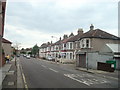
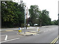
Living in IG1 4SN offers a compact, residential experience in a small cluster of homes, home to just 1,636 people. This area is defined by its proximity to transport networks and everyday conveniences, making it practical for commuters and families. The community is predominantly composed of adults aged 30–64, with a median age of 47, suggesting a stable, established population. Home ownership is high at 70%, with most properties being houses rather than flats, reflecting a traditional, family-oriented environment. The area’s safety profile is strong, with low crime risk and no flood or environmental hazards. Residents benefit from excellent digital connectivity, with broadband rated at 100 (excellent) and mobile coverage at 85 (good). Nearby, five retail stores, multiple train and metro stations, and ferry piers provide easy access to shopping, transport, and leisure. IG1 4SN is ideal for those seeking a secure, connected lifestyle with minimal environmental risk, though its small size means it’s best suited for those prioritising convenience over expansive space.
- Area Type
- Postcode
- Area Size
- Not available
- Population
- 1636
- Population Density
- 12575 people/km²
The property market in IG1 4SN is characterised by a high rate of home ownership (70%) and a predominance of houses over flats or apartments. This suggests a market skewed towards owner-occupied properties, likely appealing to families and professionals seeking stable, long-term housing. The small size of the area means the housing stock is limited, with no indication of rental properties being prevalent. Buyers should consider the proximity to transport hubs, including five rail stations and three metro stops, which enhance the area’s appeal for commuters. However, the lack of larger developments or varied property types may limit options for those seeking specific housing features. Given the low crime risk and strong digital connectivity, the area is attractive for those prioritising safety and convenience, though its compact nature means buyers must evaluate whether the immediate surroundings meet their needs.
House Prices in IG1 4SN
No properties found in this postcode.
Energy Efficiency in IG1 4SN
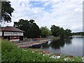
Residents of IG1 4SN have access to a range of amenities within practical reach. Five retail outlets, including Tesco Ilford, Farmfoods, and Lidl, provide everyday shopping needs. The area’s transport links—five rail stations, three metro stops, and ferry piers—ensure easy access to London’s cultural and commercial hubs. Nearby, London City Airport offers international connectivity, while ferry services from Woolwich piers provide scenic river routes. Though the area itself is small, its proximity to major stations like Ilford and Gants Hill means residents can quickly reach parks, restaurants, and leisure facilities in surrounding areas. The combination of retail, transport, and green spaces creates a lifestyle that balances convenience with access to urban amenities. For those who value ease of movement and proximity to services, IG1 4SN offers a functional, connected environment.
Amenities
Schools
| Rank | School | Type | Entry gender | Ages |
|---|
Explore more schools in this area
Go to Schools tabDemographics
The population of IG1 4SN is 1,636, with a median age of 47 and the majority of residents falling within the 30–64 age range. This suggests a community of working-age adults and older families, likely contributing to a stable local economy. Home ownership is high at 70%, indicating a strong presence of long-term residents. The predominant accommodation type is houses, which aligns with the area’s residential character. The most common ethnic group is Asian_total, reflecting a culturally diverse but cohesive community. While specific data on deprivation is not provided, the high home ownership and low crime risk suggest a relatively affluent or stable demographic. The absence of significant planning constraints or environmental risks further supports a quality of life focused on safety and accessibility. This profile indicates a mature, settled population with established ties to the area.
Household Size
Accommodation Type
Tenure
Ethnic Group
Religion
Household Composition
Age
Household Deprivation
NS-SEC
Explore more demographic insights in this area
Go to Demographics tabPlanning
Planning Constraints
- Flood RiskPremium
- Ramsar Wetland SitesPremium
- Area of Outstanding Natural BeautyPremium
- Protected Nature ReservePremium
- Protected WoodlandPremium