Area Overview for IG1 3TS
Photos of IG1 3TS


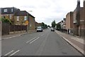
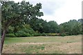
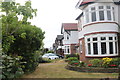
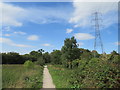
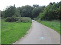
47 photos from this area
Area Information
Key information about the IG1 3TS including its size, population, and administrative classification.
- Area Type
- Postcode
- Area Size
- 2.2 hectares
- Population
- 1606
- Population Density
- 7032 people/km²
House Prices in IG1 3TS
34
Properties
£263,811
Average Sold Price
£32,290
Lowest Price
£700,000
Highest Price
Showing 34 properties
| Address | Type | Beds | Baths | Last Sale Price | Last Sale Date | |
|---|---|---|---|---|---|---|
| 303 Wanstead Park Road, Ilford, IG1 3TS | Terraced | 3 | 1 | £570,000 | Nov 2024 | |
| 325 Wanstead Park Road, Ilford, IG1 3TS | Terraced | 4 | 2 | £700,000 | Aug 2023 | |
| 341 Wanstead Park Road, Ilford, IG1 3TS | house | - | - | £560,000 | Nov 2020 | |
| 339 Wanstead Park Road, Ilford, IG1 3TS | house | - | - | £515,000 | Sep 2020 | |
| 323 Wanstead Park Road, Ilford, IG1 3TS | Terraced | 4 | 2 | £571,250 | Oct 2018 | |
| 309 Wanstead Park Road, Ilford, IG1 3TS | house | 3 | - | £270,000 | Aug 2012 | |
| 311 Wanstead Park Road, Ilford, IG1 3TS | house | 4 | 2 | £270,000 | Oct 2008 | |
| 331 Wanstead Park Road, Ilford, IG1 3TS | Flat | 2 | 1 | £295,000 | Oct 2008 | |
| 333 Wanstead Park Road, Ilford, IG1 3TS | Flat | - | - | £135,000 | Feb 2006 | |
| 343 Wanstead Park Road, Ilford, IG1 3TS | Terraced | - | - | £337,500 | Sep 2004 |
Page 1 of 4
Energy Efficiency in IG1 3TS
Amenities
Schools
| Rank | School | Type | Entry gender | Ages |
|---|
Explore more schools in this area
Go to Schools tabDemographics
Household Size
Family (3-5 people)
most common
Accommodation Type
Houses
most common
Tenure
61
majority
Ethnic Group
asian_total
most common
Religion
N/A
most common
Household Composition
N/A
most common
Age
47
median
Adults (30-64 years)
most common
Household Deprivation
N/A
with no deprivation
NS-SEC
31
in Lower managerial occupations
Explore more demographic insights in this area
Go to Demographics tabPlanning
Planning Constraints
- Flood RiskPremium
- Ramsar Wetland SitesPremium
- Area of Outstanding Natural BeautyPremium
- Protected Nature ReservePremium
- Protected WoodlandPremium