Area Overview for IG1 3JZ
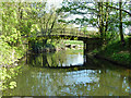
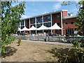
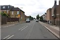
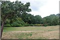
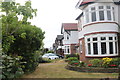
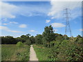
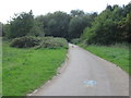
Photos of IG1 3JZ


Area Information
Living in IG1 3JZ means being part of a small, tightly knit residential cluster in England, home to 1,467 people. This postcode area is characterised by its compact size and proximity to key transport hubs, making it a practical choice for those prioritising connectivity. The community here is predominantly composed of adults aged 30–64, with a strong emphasis on home ownership—74% of residents own their homes. The area’s housing stock is largely made up of houses, reflecting a stable, established demographic. Daily life in IG1 3JZ balances suburban comfort with access to urban amenities. Residents benefit from nearby retail outlets like Tesco Ilford and Sainsburys Gants Hill, as well as multiple train and bus services. While the area lacks natural conservation designations, its low flood risk and proximity to London City Airport make it a pragmatic location for commuters and families seeking a mix of convenience and affordability.
- Area Type
- Postcode
- Area Size
- Not available
- Population
- 1467
- Population Density
- 6868 people/km²
The property market in IG1 3JZ is dominated by owner-occupied homes, with 74% of residents living in properties they own. This contrasts with areas where rental markets dominate, indicating a community focused on long-term investment rather than transient tenancy. The accommodation type is largely houses, which are typically larger and suited to families or individuals seeking more space. This housing stock suggests a market that may appeal to buyers looking for stability and permanence. However, the small size of the postcode area means the immediate surroundings are critical for property seekers. Buyers should consider the limited local infrastructure and the reliance on nearby towns for broader amenities. The predominance of houses also implies a lower density of apartments or flats, which may influence availability for different buyer profiles.
House Prices in IG1 3JZ
No properties found in this postcode.
Energy Efficiency in IG1 3JZ
Residents of IG1 3JZ have access to a range of amenities within practical reach. Retail options include Iceland Gants, Tesco Ilford, and Sainsburys Gants Hill, ensuring everyday shopping needs are met. The area’s transport network includes five metro stations and rail services at Ilford and Woodgrange Park, offering frequent connections to London’s suburbs and central areas. For leisure, nearby ferry services at Woolwich and North Greenwich piers provide scenic river travel options. While the area lacks major parks or green spaces, its proximity to urban centres means residents can access cultural and recreational facilities in nearby towns. The combination of retail, transport, and ferry access creates a lifestyle that balances convenience with the need for broader urban engagement.
Amenities
Schools
| Rank | School | Type | Entry gender | Ages |
|---|
Explore more schools in this area
Go to Schools tabDemographics
The population of IG1 3JZ is skewed towards middle-aged adults, with a median age of 47 and the majority of residents falling within the 30–64 age range. This suggests a community rooted in stability, with a significant proportion of residents likely to be in their prime working years. Home ownership is high at 74%, indicating a preference for long-term residency over rental properties. The area is predominantly composed of houses, which aligns with the demographic profile of established families. The predominant ethnic group is Asian, reflecting a distinct cultural composition. While no specific deprivation data is provided, the high home ownership rate and age profile suggest a relatively secure economic environment. However, the absence of detailed socioeconomic breakdowns means broader quality-of-life implications remain unexplored.
Household Size
Accommodation Type
Tenure
Ethnic Group
Religion
Household Composition
Age
Household Deprivation
NS-SEC
Explore more demographic insights in this area
Go to Demographics tabPlanning
Planning Constraints
- Flood RiskPremium
- Ramsar Wetland SitesPremium
- Area of Outstanding Natural BeautyPremium
- Protected Nature ReservePremium
- Protected WoodlandPremium