Area Overview for IG1 3JP
Photos of IG1 3JP


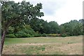
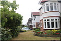
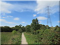
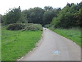
47 photos from this area
Area Information
Key information about the IG1 3JP including its size, population, and administrative classification.
- Area Type
- Postcode
- Area Size
- 8084 m²
- Population
- 1523
- Population Density
- 11986 people/km²
House Prices in IG1 3JP
30
Properties
£355,586
Average Sold Price
£102,000
Lowest Price
£770,000
Highest Price
Showing 30 properties
| Address | Type | Beds | Baths | Last Sale Price | Last Sale Date | |
|---|---|---|---|---|---|---|
| 56 Ranelagh Gardens, Cranbrook, Ilford, IG1 3JP | Terraced | 4 | 2 | £770,000 | Oct 2025 | |
| 39 Ranelagh Gardens, Cranbrook, Ilford, IG1 3JP | Terraced | 4 | 1 | £685,000 | Feb 2025 | |
| 55B Ranelagh Gardens, Cranbrook, Ilford, IG1 3JP | Flat | - | - | £170,382 | Jun 2023 | |
| 44 Ranelagh Gardens, Cranbrook, Ilford, IG1 3JP | Terraced | 4 | - | £638,000 | Nov 2019 | |
| 49 Ranelagh Gardens, Cranbrook, Ilford, IG1 3JP | Terraced | 6 | - | £685,000 | Aug 2019 | |
| 51A Ranelagh Gardens, Cranbrook, Ilford, IG1 3JP | Maisonette | - | - | £347,000 | Apr 2018 | |
| 52B Ranelagh Gardens, Cranbrook, Ilford, IG1 3JP | Terraced | 6 | 1 | £270,000 | Nov 2016 | |
| 52A Ranelagh Gardens, Cranbrook, Ilford, IG1 3JP | Flat | - | - | £250,000 | Nov 2016 | |
| 51 Ranelagh Gardens, Cranbrook, Ilford, IG1 3JP | Flat | - | - | £358,000 | Aug 2016 | |
| 58 Ranelagh Gardens, Cranbrook, Ilford, IG1 3JP | house | - | - | £240,000 | May 2015 |
Page 1 of 3
Energy Efficiency in IG1 3JP
Amenities
Schools
| Rank | School | Type | Entry gender | Ages |
|---|
Explore more schools in this area
Go to Schools tabDemographics
Household Size
Family (3-5 people)
most common
Accommodation Type
Flats
most common
Tenure
45
majority
Ethnic Group
asian_total
most common
Religion
N/A
most common
Household Composition
N/A
most common
Age
47
median
Adults (30-64 years)
most common
Household Deprivation
N/A
with no deprivation
NS-SEC
29
in Lower managerial occupations
Explore more demographic insights in this area
Go to Demographics tabPlanning
Planning Constraints
- Flood RiskPremium
- Ramsar Wetland SitesPremium
- Area of Outstanding Natural BeautyPremium
- Protected Nature ReservePremium
- Protected WoodlandPremium