Area Overview for IG1 2RW
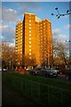
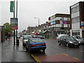
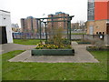
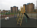
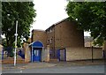
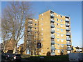
Photos of IG1 2RW


Area Information
Living in IG1 2RW means being part of a tightly knit residential cluster in east London, home to 2,231 residents. The area’s compact size fosters a sense of familiarity, with daily life shaped by its proximity to transport hubs and local amenities. Residents here are predominantly adults aged 30–64, reflecting a mature community with established routines. The area’s character is defined by its practicality: flats dominate the housing stock, and the population’s diversity is marked by a strong presence of the Asian community. Commuting is straightforward, with multiple rail and metro stations within reach, while nearby retail options like Sainsburys and Lidl cater to everyday needs. Though small, the area balances accessibility with a quiet residential feel, making it suitable for those prioritising convenience without sacrificing a sense of community. The presence of two primary schools, including one rated outstanding by Ofsted, adds to its appeal for families. However, the high crime risk reported in assessments underscores the need for vigilance in this urban setting.
- Area Type
- Postcode
- Area Size
- Not available
- Population
- 2231
- Population Density
- 8985 people/km²
The property market in IG1 2RW is characterised by a low home ownership rate of 29%, indicating that the majority of residents rent their homes. Flats are the primary accommodation type, which reflects the area’s compact layout and likely proximity to transport links. This suggests a rental market that caters to commuters or those seeking affordable housing in a convenient location. The limited owner-occupied properties may make it challenging for buyers seeking long-term investment, though the small size of the area means the housing stock is concentrated. For those considering purchasing, the prevalence of flats could mean limited scope for property customisation or expansion. The market is likely influenced by broader regional trends in London, where rental demand often outstrips supply. Buyers should also consider the area’s safety profile, as high crime risk assessments may affect property desirability and insurance costs.
House Prices in IG1 2RW
No properties found in this postcode.
Energy Efficiency in IG1 2RW
Residents of IG1 2RW benefit from a range of amenities within easy reach. Retail options include Sainsburys Ilford, Iceland Ilford, and Lidl High, providing access to groceries, household essentials, and convenience shopping. The area’s transport network ensures quick access to major hubs like Ilford Station and Whipps Cross Bus Interchange, supporting both daily commutes and weekend excursions. For leisure, nearby ferry piers such as Woolwich Arsenal Pier offer water-based travel options, while the proximity to London City Airport caters to frequent flyers. Although the area lacks detailed information on parks or recreational spaces, its transport links suggest opportunities for exploring larger green spaces in surrounding boroughs. The combination of retail, transport, and travel options creates a functional lifestyle, ideal for those prioritising accessibility over expansive local amenities.
Amenities
Schools
Residents of IG1 2RW have access to two primary schools: Cleveland Road Primary School, which holds an outstanding Ofsted rating, and Cleveland Infants’ School. Both institutions cater to younger children, with the latter likely focusing on early years education. The presence of two primary schools within the area provides families with options, though the absence of secondary schools nearby means students may need to travel for further education. The outstanding rating at Cleveland Road Primary suggests high standards of teaching and facilities, which could be a significant draw for families prioritising quality education. However, the lack of detailed performance data for Cleveland Infants’ School means its specific strengths or challenges are not quantified. For parents, the proximity of these schools reduces commuting time and supports a community-oriented approach to education.
| Rank | School | Type | Entry gender | Ages |
|---|
Explore more schools in this area
Go to Schools tabDemographics
The population of IG1 2RW is 2,231, with a median age of 47, indicating a community of primarily middle-aged adults. The most common age range is 30–64, suggesting a stable demographic with established careers and families. Home ownership is relatively low at 29%, reflecting a rental-dominated market. The accommodation type is predominantly flats, which aligns with the area’s density and the prevalence of multi-unit housing. The predominant ethnic group is Asian, which shapes the cultural fabric of the neighbourhood. This demographic profile implies a community with strong family ties and a focus on long-term stability. The low home ownership rate may indicate a transient population or a focus on rental affordability, though it also suggests limited opportunities for property investment. The absence of specific deprivation data means the area’s quality of life cannot be fully assessed, but the presence of essential services and schools suggests a baseline of accessibility for residents.
Household Size
Accommodation Type
Tenure
Ethnic Group
Religion
Household Composition
Age
Household Deprivation
NS-SEC
Explore more demographic insights in this area
Go to Demographics tabPlanning
Planning Constraints
- Flood RiskPremium
- Ramsar Wetland SitesPremium
- Area of Outstanding Natural BeautyPremium
- Protected Nature ReservePremium
- Protected WoodlandPremium