Area Overview for IG1 2EW
Photos of IG1 2EW
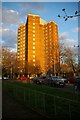

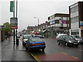
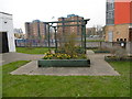
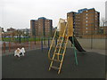

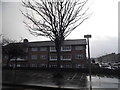


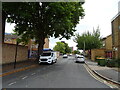
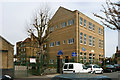
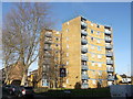
39 photos from this area
Area Information
Key information about the IG1 2EW including its size, population, and administrative classification.
- Area Type
- Postcode
- Area Size
- 1.2 hectares
- Population
- 1773
- Population Density
- 14945 people/km²
House Prices in IG1 2EW
44
Properties
£251,547
Average Sold Price
£70,000
Lowest Price
£540,000
Highest Price
Showing 44 properties
| Address | Type | Beds | Baths | Last Sale Price | Last Sale Date | |
|---|---|---|---|---|---|---|
| 36 Cecil Road, Ilford, IG1 2EW | Terraced | 3 | 2 | £540,000 | Mar 2025 | |
| 20 Cecil Road, Ilford, IG1 2EW | Terraced | 3 | - | £540,000 | May 2022 | |
| 29 Cecil Road, Ilford, IG1 2EW | house | - | - | £450,000 | Mar 2021 | |
| 9 Cecil Road, Ilford, IG1 2EW | Terraced | 5 | 2 | £370,000 | Feb 2016 | |
| 19 Cecil Road, Ilford, IG1 2EW | Terraced | 3 | 1 | £357,000 | Mar 2015 | |
| 21 Cecil Road, Ilford, IG1 2EW | house | - | - | £250,000 | Jun 2013 | |
| 25 Cecil Road, Ilford, IG1 2EW | house | - | - | £250,000 | Apr 2013 | |
| 40 Cecil Road, Ilford, IG1 2EW | house | 3 | - | £250,000 | Sep 2011 | |
| 33A Cecil Road, Ilford, IG1 2EW | Flat | 1 | 1 | £225,000 | Mar 2008 | |
| 33 Cecil Road, Ilford, IG1 2EW | Flat | - | - | £165,000 | Dec 2006 |
Page 1 of 5
Energy Efficiency in IG1 2EW
Amenities
Schools
| Rank | School | Type | Entry gender | Ages |
|---|
Explore more schools in this area
Go to Schools tabDemographics
Household Size
Family (3-5 people)
most common
Accommodation Type
Houses
most common
Tenure
40
majority
Ethnic Group
asian_total
most common
Religion
N/A
most common
Household Composition
N/A
most common
Age
47
median
Adults (30-64 years)
most common
Household Deprivation
N/A
with no deprivation
NS-SEC
18
in Lower managerial occupations
Explore more demographic insights in this area
Go to Demographics tabPlanning
Planning Constraints
- Flood RiskPremium
- Ramsar Wetland SitesPremium
- Area of Outstanding Natural BeautyPremium
- Protected Nature ReservePremium
- Protected WoodlandPremium