Area Overview for IG1 1RW
Photos of IG1 1RW
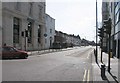
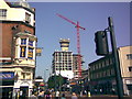
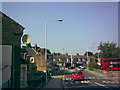
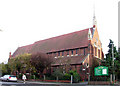
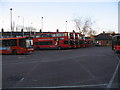

93 photos from this area
Area Information
Key information about the IG1 1RW including its size, population, and administrative classification.
- Area Type
- Postcode
- Area Size
- 8643 m²
- Population
- 2977
- Population Density
- 11684 people/km²
House Prices in IG1 1RW
61
Properties
£190,766
Average Sold Price
£50,000
Lowest Price
£559,998
Highest Price
Showing 61 properties
| Address | Type | Beds | Baths | Last Sale Price | Last Sale Date | |
|---|---|---|---|---|---|---|
| 8 Stanley Road, Ilford, IG1 1RW | Terraced | 3 | 1 | £440,000 | Feb 2025 | |
| 1 Stanley Road, Ilford, IG1 1RW | Terraced | 3 | 2 | £490,000 | Jul 2024 | |
| 17 Stanley Road, Ilford, IG1 1RW | Flat | - | - | £559,998 | Jun 2024 | |
| 9 Stanley Road, Ilford, IG1 1RW | house | - | - | £262,500 | Mar 2023 | |
| 14 Stanley Road, Ilford, IG1 1RW | Terraced | 3 | 1 | £455,000 | Mar 2023 | |
| 21 Stanley Road, Ilford, IG1 1RW | Terraced | - | - | £60,000 | Mar 2021 | |
| 53 Stanley Road, Ilford, IG1 1RW | Terraced | 2 | - | £375,000 | Mar 2021 | |
| 49 Stanley Road, Ilford, IG1 1RW | house | - | - | £261,000 | Sep 2020 | |
| 33 Stanley Road, Ilford, IG1 1RW | Terraced | 3 | 1 | £250,000 | Apr 2014 | |
| 39 Stanley Road, Ilford, IG1 1RW | house | - | - | £190,000 | Mar 2013 |
Page 1 of 7
Energy Efficiency in IG1 1RW
Amenities
Schools
| Rank | School | Type | Entry gender | Ages |
|---|
Explore more schools in this area
Go to Schools tabDemographics
Household Size
Family (3-5 people)
most common
Accommodation Type
Flats
most common
Tenure
24
majority
Ethnic Group
asian_total
most common
Religion
N/A
most common
Household Composition
N/A
most common
Age
47
median
Adults (30-64 years)
most common
Household Deprivation
N/A
with no deprivation
NS-SEC
24
in Lower managerial occupations
Explore more demographic insights in this area
Go to Demographics tabPlanning
Planning Constraints
- Flood RiskPremium
- Ramsar Wetland SitesPremium
- Area of Outstanding Natural BeautyPremium
- Protected Nature ReservePremium
- Protected WoodlandPremium