Area Overview for IG1 1EJ
Photos of IG1 1EJ
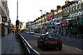
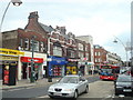
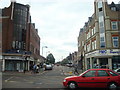
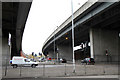
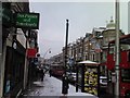
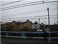
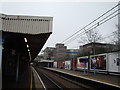
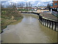
100 photos from this area
Area Information
Key information about the IG1 1EJ including its size, population, and administrative classification.
- Area Type
- Postcode
- Area Size
- 1.4 hectares
- Population
- 2231
- Population Density
- 8985 people/km²
House Prices in IG1 1EJ
53
Properties
£249,672
Average Sold Price
£55,000
Lowest Price
£570,000
Highest Price
Showing 53 properties
| Address | Type | Beds | Baths | Last Sale Price | Last Sale Date | |
|---|---|---|---|---|---|---|
| 40 Bedford Road, Ilford, IG1 1EJ | Terraced | 3 | 2 | £450,000 | Sep 2025 | |
| 4 Bedford Road, Ilford, IG1 1EJ | Terraced | 3 | 1 | £465,000 | Jul 2022 | |
| 33 Bedford Road, Ilford, IG1 1EJ | house | - | - | £570,000 | Oct 2021 | |
| 11 BEDFORD ROAD, Ilford, IG1 1EJ | Detached | 4 | 2 | £480,000 | May 2017 | |
| 49 Bedford Road, Ilford, IG1 1EJ | Terraced | 3 | 1 | £240,000 | Dec 2015 | |
| 42 Bedford Road, Ilford, IG1 1EJ | house | - | - | £113,100 | May 2014 | |
| Fern Leaf Care, 38 Bedford Road, Ilford, IG1 1EJ | house | - | - | £300,000 | Jul 2008 | |
| 39 Bedford Road, Ilford, IG1 1EJ | house | - | - | £280,000 | Jun 2007 | |
| 3 Bedford Road, Ilford, IG1 1EJ | Terraced | - | - | £328,000 | May 2007 | |
| 22 Bedford Road, Ilford, IG1 1EJ | Terraced | - | - | £370,000 | Mar 2007 |
Page 1 of 6
Energy Efficiency in IG1 1EJ
Amenities
Schools
| Rank | School | Type | Entry gender | Ages |
|---|
Explore more schools in this area
Go to Schools tabDemographics
Household Size
Family (3-5 people)
most common
Accommodation Type
Flats
most common
Tenure
29
majority
Ethnic Group
asian_total
most common
Religion
N/A
most common
Household Composition
N/A
most common
Age
47
median
Adults (30-64 years)
most common
Household Deprivation
N/A
with no deprivation
NS-SEC
28
in Lower managerial occupations
Explore more demographic insights in this area
Go to Demographics tabPlanning
Planning Constraints
- Flood RiskPremium
- Ramsar Wetland SitesPremium
- Area of Outstanding Natural BeautyPremium
- Protected Nature ReservePremium
- Protected WoodlandPremium