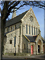
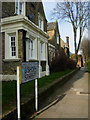
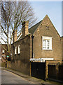
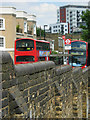
Area Overview for Hoxton West Ward
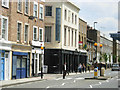
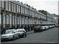
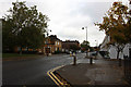
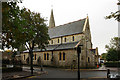
Photos of Hoxton West Ward
Area Information
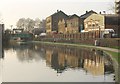
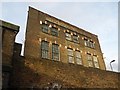
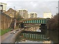
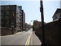
Living in Hoxton West Ward offers a distinct experience within the broader East London landscape. This ward covers a compact area of 64.8 hectares, yet it accommodates 3,145 residents. That density results in a population concentration of 4,855 people per square kilometre, creating a tightly knit environment where neighbours are often close by. The ward functions as a defined borough unitary division, situated firmly in England. For you, this means daily life happens in a relatively small footprint where movement is generally quick and local knowledge travels fast. The area is not sprawling; choices for where to walk or cycle are confined by the ward's precise boundaries. You are trading space for community connection in a zone where every hectare holds significant weight. When considering homes in Hoxton West Ward, you enter a market characterised by this specific intensity. The physical size of the ward dictates that amenities are likely to be concentrated within a short walking distance. This compactness shapes how you buy property and how you navigate the local daily routine.
- Area Type
- District Borough Unitary Ward
- Area Size
- 64.8 hectares
- Population
- 3145
- Population Density
- 4855 people/km²
Demographics
The community profile of Hoxton West Ward presents a strikingly older demographic compared to much of the rest of the country. With a median age of 70, the population skews heavily towards retirees and senior citizens. Most commonly, households consist of individuals in this older age bracket, rather than young families or single professionals. You will find that the social fabric reflects this shift, with activities and services likely catering to an older generation. Home ownership stands at a mere 23%, which is remarkably low for a predominantly senior area. The remaining 77% consists of renters or shared living arrangements. Accommodation types are mixed but lean heavily towards rental stock, given the scarcity of freeholders. The ward shows no specific predominant ethnic group or religious affiliation in the available records, suggesting a diverse population that does not favour one single identity over another. For anyone wondering about deprivation, the data points do not highlight acute poverty in this ward. Instead, the defining characteristic is the age structure. Living in Hoxton West Ward means engaging with a settled, elder-focused community where life paces are generally slower and more routine-oriented.
Household Size
Accommodation Type
Tenure
Ethnic Group
Religion
Household Composition
Age
Household Deprivation
NS-SEC
Explore more demographic insights in this area
Go to Demographics tabPlanning
Planning Constraints
- Flood RiskPremium
- Ramsar Wetland SitesPremium
- Area of Outstanding Natural BeautyPremium
- Protected Nature ReservePremium
- Protected WoodlandPremium
- Crime RiskPremium