Area Overview for Hounslow
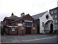
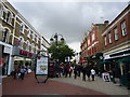
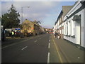
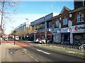
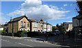
Photos of Hounslow


Area Information
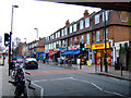
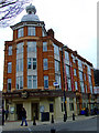
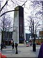
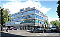
Hounslow occupies a significant position on the western edge of London, serving as a distinct town and local authority district within the London Borough of Hounslow. This built-up area covers 40.7 square kilometres and holds a population of 126,132 residents. You will find Hounslow situated along the High Street, which follows an ancient Roman road known as the Bath Road. The settlement lies on the boundary between the historic parishes of Heston and Isleworth in Vale of pytest, originally located in the former county of Middlesex. Life centre on the valley near the Thames, offering a blend of historical significance and modern connectivity. The town evolved from a simple staging post with royal mail coaches in 1784 to a formal borough under the Local Government Act of 1965. Many today discover the location's roots in the Priory of Holy Trinity, founded in 1214. You can explore landmarks like the former Hounslow Cavalry Barracks and the 1858 Town Hall while navigating daily life. This geography places you close to major transport hubs, making it a practical choice for those working in the capital or exploring the wider region. The area's identity remains tightly linked to its long history as a transport corridor.
- Area Type
- District/Borough
- Area Size
- 40.7 km²
- Population
- 126132
- Population Density
- 3102 people/km²
Demographics
The community in Hounslow displays a specific demographic profile that shapes the local atmosphere and daily interactions. The median age for residents sits at 70 years, indicating a population skewed significantly towards older demographics. Most data records list the age breakdown under the broad 'Total' category, confirming the prevalence of this age group within the household composition. Regarding accommodation, you will find that 49% of homes in Hounslow are owner-occupied, while the remaining properties are typically part of the private or social rental market. This split suggests a balanced environment where long-term residents mix with renters. Ethical and religious breakdowns appear in the general total data, reflecting a diverse community without a single dominant group defined by those specific metrics. While exact deprivation figures are not listed in the provided record, the crime risk assessment of 61 out of 100 offers a tangible measure of safety concerns. A score here indicates a medium crime risk, meaning standard security precautions remain necessary for anyone living in Hounslow. The area is not classified as extremely high or extremely low risk, placing it in a middle ground of urban living. You should expect a neighbourhood where age and tenure mix create a steady, established environment.