Area Overview for High Barnet Ward
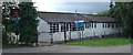
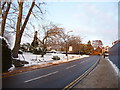
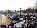
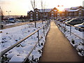
Photos of High Barnet Ward


Area Information
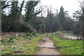
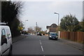
High Barnet Ward sits as an electoral ward within the London Borough of Barnet, occupying a distinct corner of Outer London. This district covers an area of 8.1 square kilometres and forms a part of the northern suburbs of the capital. At its heart lies the historic town of Chipping Barnet, which overlooks the surrounding valley from a hilltop position. You will find yourself standing near the coordinates 51.6526°N, -0.2230°W when visiting the centre of this historic settlement. The area evolved from a rural manor into a coaching stop during the eighteenth century before becoming a London suburb after railway services arrived in the nineteenth century. Today, daily life revolves around a mix of historic charm and modern convenience, anchored by the Northern line terminus at High Barnet station which opened in 1872. Residents enjoy proximity to a chartered market that has existed since 1199, now located at The Spires Shopping Centre on Stapylton Road. The presence of Tudor Hall, built around 1577, provides a tangible link to Queen Elizabeth I's era. You can also visit Barnet Well, which returned to public use after restoration in 2023. Living in High Barnet Ward means residing in a setting where history is layered over everyday suburbia, yet you remain integrated into the wider city infrastructure.
- Area Type
- District Borough Unitary Ward
- Area Size
- 8.1 km²
- Population
- Not available
- Population Density
- Not available
Demographics
The community in High Barnet Ward leans significantly towards an older demographic, with a median age of 70 years. This figure indicates that the population skews towards retirement age compared to the broader national average. Most households reflect this age profile, with the total age distribution showing a clear preference for senior residents. Independence in this ward is quite high, as evidenced by a home ownership rate of 69 per cent. This means nearly seven out of ten residents own their dwellings outright or with a mortgage, suggesting financial stability and long-term settlement rather than transient renting. The ward falls under the category of total household composition and total accommodation type, indicating no specific exclusionary filters on the housing stock data available. While the area has a substantial senior population, the presence of a historic market and transport links keeps the community interactive and connected. The high level of ownership translates into a stable neighbourhood where many families have invested deeply in their local environment. There is little evidence of a transient rental culture dominating the landscape, allowing the character of the district to remain consistent year after year.
Household Size
Accommodation Type
Tenure
Ethnic Group
Religion
Household Composition
Age
Household Deprivation
NS-SEC
Explore more demographic insights in this area
Go to Demographics tabPlanning
Planning Constraints
- Flood RiskPremium
- Ramsar Wetland SitesPremium
- Area of Outstanding Natural BeautyPremium
- Protected Nature ReservePremium
- Protected WoodlandPremium
- Crime RiskPremium