Area Overview for Heston West Ward
Photos of Heston West Ward


Area Information
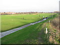
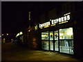
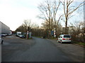
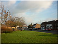
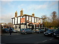
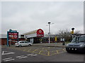
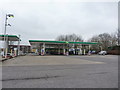
Heston West Ward is a distinct electoral district within the London Borough of Hounslow, covering a compact area of 3.7 square kilometres. Despite its relatively small size, the ward accommodates a population of 1,767 residents according to the latest ward-level data, creating a densely populated local community. This landscape differs significantly from the wider warehousing and industrial zones often associated with the Heston name outside the immediate borough. Within these specific boundaries, daily life revolves around established suburban patterns found in the Heston area. The ward has existed as a current electoral division since 1965, providing a stable political and administrative framework for neighbourhood governance. Residents benefit from a defined suburbia that sits comfortably within Greater London, England. When evaluating homes in Heston West Ward, you are looking at a settled community where the land use is carefully regulated. The area returns three councillors to the local council, ensuring local representation for policy decisions that affect your street. This level of representation is crucial for managing development on the limited 3.7 km² footprint available. Visitors and potential buyers should appreciate the clear geographical focus of the ward, which separates it from wider London trends while maintaining connectivity to the city. The environment is characterised by a mix of residential street layouts and nearby amenities typical of Greater London suburbs. Living here means participating in a specific constituency with a clear identity within the broader Hounslow district. The suburbia of Heston West Ward offers a grounded reality away from the royal palace crowds often found near RAF Heston, focusing instead on local residential needs. Its location within Hounslow provides easy access to major London infrastructure without the congestion of central zones. You can expect a familiar suburban experience with defined neighbourhoods and consistent local services. The ward serves as a key component of the broader Heston area, contributing to its overall character as a London suburb. Understanding these specific boundaries helps you grasp the true scale and context of your potential new home. The area remains an integral part of the London Borough landscape, blending local identity with city-wide convenience.
- Area Type
- District Borough Unitary Ward
- Area Size
- 3.7 km²
- Population
- 1767
- Population Density
- 480 people/km²
Demographics
The community in Heston West Ward displays a notably mature demographic profile, with a median age of 70 years. This figure indicates that the area is populated primarily by older adults rather than young families or single professionals. At a time when many London suburbs attract younger buyers, Heston West stands apart with this age structure. The most common age category spans the total population, reinforcing the view that this is a consolidated neighbourhood rather than one in flux. You will find a mix of long-term residents deeply embedded in the local fabric of the ward. Home ownership rates in the area stand at 46 per cent, meaning slightly less than half of all households own their property outright. This suggests a dynamic rental market exists alongside owner-occupied homes, catering to various household needs. The remaining 54 per cent of households are likely renters, which adds diversity to the types of people living in the neighbourhood. While specific data on household composition types and predominant ethnic groups is not available for this specific ward, the current owner-occupier percentage dictates the rhythm of the community. The high median age suggests a population that values stability and established local services over the rapid turnover common in younger areas. This demographic reality shapes the daily experience for anyone moving there. With older residents dominating the scene, the atmosphere is likely quiet and settled, devoid of the constant vibrancy found in student towns or young professional hubs. You should approach the community with an understanding that neighbours may be here for decades. The 46 per cent ownership rate means you will encounter both invested owners and tenants, creating a balanced social environment. While lack of detailed ethnicity data prevents a full cultural picture, the age profile offers a clear indication of lifestyle compatibility. Homes in Heston West Ward appeal to those seeking a calm, mature setting rather than a rapid-fire social scene.
Household Size
Accommodation Type
Tenure
Ethnic Group
Religion
Household Composition
Age
Household Deprivation
NS-SEC
Explore more demographic insights in this area
Go to Demographics tabPlanning
Planning Constraints
- Flood RiskPremium
- Ramsar Wetland SitesPremium
- Area of Outstanding Natural BeautyPremium
- Protected Nature ReservePremium
- Protected WoodlandPremium
- Crime RiskPremium