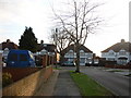
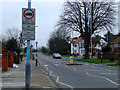
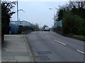
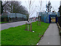
Area Overview for Heston Central Ward
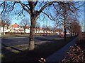
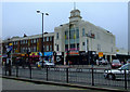
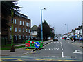
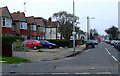
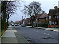
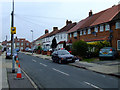
Photos of Heston Central Ward


Area Information
Heston Central Ward stands as a compact district within the London Borough of Hounslow, spanning just 1.7 square kilometres. This small footprint accommodates a population of 1925 residents, resulting in a population density of 1142 people per square kilometre. Situated in west London, the ward sits at coordinates 51.47887747071879, -0.38081092681873074 and is bordered by neighbouring wards including Heston East, Heston West, Hounslow West, and Cranford. You live here within the Feltham and Heston parliamentary constituency, a political division established for local governance. The ward evolved from a location first utilised in the 1978 elections to elect councillors to Hounslow London Borough Council. Daily life in Heston Central Ward is defined by its geographical constraints and established boundaries. Living in Heston Central Ward means navigating a close-knit electoral ward with a long history of representation. The area offers specific units for residents who prioritise a defined district identity over sprawling suburbia. Homes in Heston Central Ward sit within this bounded space, providing a clear sense of place for those who settle here.
- Area Type
- District Borough Unitary Ward
- Area Size
- 1.7 km²
- Population
- 1925
- Population Density
- 1142 people/km²
Demographics
The community in Heston Central Ward displays a distinct age profile with a median age of 70. This figure indicates that the area is dominated by older generations, making it a settlement increasingly aligned with retirement-age requirements. The most common age range spans the total population, reflecting the widespread presence of seniors within the ward. You can expect a neighbourhood where social interactions centre around the life stages of mature adults. Home ownership stands at 51%, meaning roughly half of the households are owned outright or with a mortgage. Rental properties account for almost the remaining half of the accommodation. Household composition and accommodation types are recorded under total categories, suggesting diverse living arrangements exist despite the older demographic skew. The area does not provide specific data on the dominant ethnic group or religious affiliations for the total population. While the absence of breakdown data limits a full cultural picture, the high median age suggests a community adapting to the needs of an aging population. Safety is a significant factor, with a crime risk score of 68 out of 100 indicating below-average crime rates. This low risk contributes to the quality of life for senior residents.
Household Size
Accommodation Type
Tenure
Ethnic Group
Religion
Household Composition
Age
Household Deprivation
NS-SEC
Explore more demographic insights in this area
Go to Demographics tabPlanning
Planning Constraints
- Flood RiskPremium
- Ramsar Wetland SitesPremium
- Area of Outstanding Natural BeautyPremium
- Protected Nature ReservePremium
- Protected WoodlandPremium
- Crime RiskPremium