Area Overview for Heathfield Ward
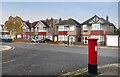
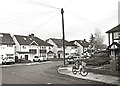
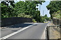
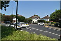
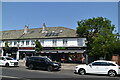
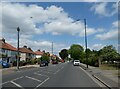
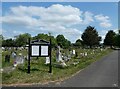
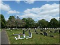
Photos of Heathfield Ward
Area Information
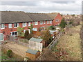
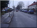
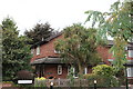
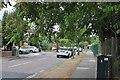
Living in Heathfield Ward offers a distinct experience within a district borough united ward, covering an area of just 1.8 square kilometres. This small footprint defines the daily rhythm for residents, where proximity often outweighs extensive travel networks. The community is characterised by a significant proportion of long-term residents, with the median age clocking in at seventy years. This demographic profile suggests a neighbourhood built around stability and established routines rather than rapid turnover. Families with young children and young professionals seeking a dynamic lifestyle are statistically less common here, making the area feel settled and quiet during the day. Daily life likely revolves around local amenities rather than commuting to distant city centres, as the local population tends to reside within the boundaries of the ward. The compact size of the community means that many essential services are naturally close by, reducing the need for frequent car journeys. While the area lacks the vibrancy of larger urban zones, the consistent low population density and older median age create a peaceful environment. Homeowners constitute the majority of the housing stock, indicating a stable property market driven by local families and retirees rather than transient tenants or speculative investors.
- Area Type
- District Borough Unitary Ward
- Area Size
- 1.8 km²
- Population
- Not available
- Population Density
- Not available
Demographics
The community in Heathfield Ward is defined by a very mature population structure. The median age of seventy signals a retirement-oriented neighbourhood where the workforce is minimal. Almost the entire demographic falls into the older age bracket, creating a homogeneous social fabric with limited generation mixing. This contrasts sharply with urban areas where twenty to thirty percent of residents are typically under twenty-five. Home ownership stands at sixty-three percent, a figure that reflects the preference of older residents for staying put until their final years. The remaining third of households are predominantly second-home owners or elderly individuals moving from larger properties. Household composition data confirms that total household numbers align with the low population count expected in a 1.8 square kilometre area. There are no specific statistics on predominant ethnic groups or religious affiliations available for this specific ward, suggesting a fairly traditional demographic makeup without significant recent migration influences. The data clearly shows an area where the primary age group is elderly, which dictates the local demand for age-friendly services and housing designs.
Household Size
Accommodation Type
Tenure
Ethnic Group
Religion
Household Composition
Age
Household Deprivation
NS-SEC
Explore more demographic insights in this area
Go to Demographics tabPlanning
Planning Constraints
- Flood RiskPremium
- Ramsar Wetland SitesPremium
- Area of Outstanding Natural BeautyPremium
- Protected Nature ReservePremium
- Protected WoodlandPremium
- Crime RiskPremium