Area Overview for Hampstead Town Ward
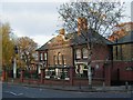
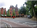
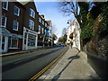
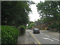
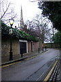
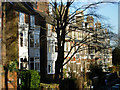
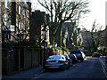
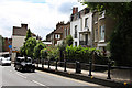
Photos of Hampstead Town Ward


Area Information
Hampstead Town Ward occupies a distinct section of London with a proud, established character. The ward covers an area of 2.2 square kilometres and holds a resident population of 2,709 people. This small footprint supports a dense environment, with population density reaching 1,228 people per square kilometre. You will find a neighbourhood that prioritises quiet living over rapid development, defined by its limited physical size and high occupancy rates. Daily life here revolves around established localities rather than the sprawling infrastructure common elsewhere in Greater London. The community functions as a tight-knit unit where every street corner and shared space is within easy reach of your door. Understanding this compact scale helps you visualise the layout as you search for homes in this specific ward. The geography dictates a lifestyle where distance to amenities remains short, allowing for a slower pace despite being part of a major metropolis. When considering living in Hampstead Town Ward, appreciate that you are choosing a defined, manageable district rather than a sprawling borough. The physical boundaries create a contained environment where local identity remains strong. This concentration of residents fosters interactions that define the area's unique atmosphere. You gain access to the full range of local services while maintaining a clear sense of place. The ward's structure ensures that the community feels distinct from surrounding areas, offering a sense of belonging that comes with smaller, well-defined districts in London.
- Area Type
- District Borough Unitary Ward
- Area Size
- 2.2 km²
- Population
- 2709
- Population Density
- 1228 people/km²
Demographics
The community in Hampstead Town Ward displays clear demographic markers that shape the local culture. The most striking figure is the median age of 70 years, which indicates an elderly population as the dominant household type. This age profile suggests the area appeals primarily to retirees seeking a settled lifestyle rather than young families or students. Home ownership stands at 53%, meaning slightly more than half of the households own their properties outright or with a mortgage. This significant rate of ownership contrasts with many city areas where renting dominates the market. The remaining households likely consist of private landlords or shared living arrangements, though specific data on tenure types is not broken down further. Accommodation diversity appears limited given the concentration of one specific age group. You should expect fewer phenomena associated with multiculturalism or religious diversity in this specific ward, as the data simply does not provide information on predominant ethnic groups or religious affiliations. Deprivation levels are not explicitly quantified in the available records, so you must rely on the ownership rate to gauge economic stability. The high proportion of older adults usually correlates with established roots and long-term residency. When evaluating schools near Hampstead Town Ward, remember that the local population is skewed heavily towards age groups typically past school age. The demographic consistency provides a stable environment for those moving specifically to join the established senior community rather than looking for a mixed-age district.
Household Size
Accommodation Type
Tenure
Ethnic Group
Religion
Household Composition
Age
Household Deprivation
NS-SEC
Explore more demographic insights in this area
Go to Demographics tabPlanning
Planning Constraints
- Flood RiskPremium
- Ramsar Wetland SitesPremium
- Area of Outstanding Natural BeautyPremium
- Protected Nature ReservePremium
- Protected WoodlandPremium