Area Overview for Hackney Wick Ward
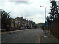
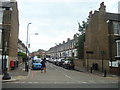
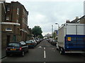
Photos of Hackney Wick Ward


Area Information
Hackney Wick Ward serves as a distinct electoral ward within the London Borough of Hackney, occupying just 1.6 km² of East London. The ward was first established for electoral purposes during the 2014 elections and has since returned three councillors to the Hackney London Borough Council. Residents live in the Hackney Wick area, which falls under the broader Hackney South and Shoreditch constituency. According to 2021 census data, this compact ward houses a population of 12,308 residents. This density creates a relatively tight-knit environment typical of its size. The ward includes significant infrastructure points such as Hackney Wick Railway Station and the East Cross Centre, which serve as key community anchors. These locations define the daily rhythm for those living in Hackney Wick Ward. The boundary history dates back to 1993 when legislative orders transferred portions of Hackney Wick between boroughs. These changes redefined the local geography around the station and the East Cross Centre. Living in Hackney Wick Ward means navigating a space with deep administrative roots and specific physical limits. You explore an area where every house could be within shouting distance of your neighbour. The compact nature ensures that you can walk to many local amenities without needing a car.
- Area Type
- District Borough Unitary Ward
- Area Size
- 1.6 km²
- Population
- Not available
- Population Density
- Not available
Demographics
The community profile of Hackney Wick Ward reveals a population with a significant proportion of older residents. The median age for the ward stands at 70, indicating a mature demographic compared to many modern London areas. Census data from the provided records classifies the total age distribution as the most common range, without breaking down younger cohorts specifically. This high median suggests that retirees or long-term settled families form the core of the population. Home ownership levels are relatively low within the ward, with only 24% of residents owning their homes outright. The remaining 76% likely reside in private or social rentals, suggesting a strong let market. Household composition and accommodation type data are available in the official records as total aggregates, providing a full picture of living arrangements. Ethical diversity and religious breakdown are also recorded in full totals for the area. You must consider the implications of a community where nearly three quarters of people do not own their property. This dynamic often influences local engagement and long-term investment in the neighbourhood. The age profile means that you will encounter a population that may value stability and established community ties. When planning your move to Hackney Wick Ward, you should understand that you are joining a settled demographic rather than a transient youth hub.
Household Size
Accommodation Type
Tenure
Ethnic Group
Religion
Household Composition
Age
Household Deprivation
NS-SEC
Explore more demographic insights in this area
Go to Demographics tabPlanning
Planning Constraints
- Flood RiskPremium
- Ramsar Wetland SitesPremium
- Area of Outstanding Natural BeautyPremium
- Protected Nature ReservePremium
- Protected WoodlandPremium
- Crime RiskPremium