Area Overview for HA9 9JT
Photos of HA9 9JT


Area Information
HA9 9JT is a small residential postcode area in England, home to 1,359 residents. Its compact size means it is a tightly knit community, with a focus on practical living. The area’s demographic profile suggests a mature population, with a median age of 47 and the majority of residents falling within the 30-64 age range. This suggests a stable, established community with a strong presence of working-age adults. The area is characterised by flats, reflecting a rental market dynamic, with only 16% of homes owner-occupied. Despite its small size, HA9 9JT is well-connected, with nearby amenities including retail outlets, transport hubs, and schools. The presence of Ark Academy, an outstanding-rated academy, adds value for families. While the area has no major natural constraints, it faces a critical safety challenge: high crime risk, which requires attention for prospective buyers. Daily life here balances convenience with the need for vigilance, particularly in ensuring home security.
- Area Type
- Postcode
- Area Size
- Not available
- Population
- 1359
- Population Density
- 7575 people/km²
The property market in HA9 9JT is dominated by flats, with 16% of homes owner-occupied. This suggests a rental market dynamic, where most residents do not own their properties. The small size of the area means housing stock is limited, and the focus on flats indicates a lack of larger family homes or detached properties. For buyers, this presents challenges: the area is not a traditional owner-occupied market, and opportunities for purchase may be constrained by the availability of flats. The low home ownership rate could also mean higher competition for available properties, particularly among those seeking long-term investment. Given the area’s size, buyers should consider nearby zones for more varied housing options. The predominance of rental properties may also influence local demand, with landlords potentially prioritising short-term lettings over long-term sales.
House Prices in HA9 9JT
No properties found in this postcode.
Energy Efficiency in HA9 9JT
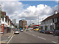
Living in HA9 9JT offers access to a range of amenities within practical reach. Retail options include Asda Wembley, Lidl Stadium RP, and Co-op Wembley, providing everyday shopping convenience. The area’s transport links connect residents to major hubs like Wembley Stadium and North Wembley Station, enhancing accessibility to events and workplaces. Ferries from Little Venice and London Zoo stops offer scenic routes to attractions, while RAF Northolt airport provides regional travel options. The presence of multiple metro and rail stations ensures efficient commuting, supporting both work and leisure. Despite its small size, HA9 9JT balances practicality with connectivity, allowing residents to enjoy urban amenities without sacrificing proximity to essential services. The combination of retail, transport, and leisure options creates a functional lifestyle, though the area’s limited size may require residents to venture slightly further for more specialised facilities.
Amenities
Schools
The nearest school to HA9 9JT is Ark Academy, an outstanding-rated academy. This designation reflects high educational standards and effective teaching, which is a significant draw for families. The presence of a single academy suggests a focused educational offering, though no other schools are listed in the data. For parents, Ark Academy’s Ofsted rating indicates a reliable institution, but the absence of additional schools—such as primary or secondary options—may limit choices. The area’s small size means proximity to the academy is a key factor in its appeal. However, families requiring multiple educational stages may need to look beyond HA9 9JT for comprehensive schooling options. The quality of Ark Academy, combined with the area’s connectivity, positions it as a viable option for those prioritising academic excellence.
| Rank | School | Type | Entry gender | Ages |
|---|
Explore more schools in this area
Go to Schools tabDemographics
The population of HA9 9JT is predominantly adults aged 30-64, with a median age of 47. This suggests a community of established professionals and families, with fewer younger residents or retirees. Only 16% of homes are owner-occupied, indicating a rental-heavy market, which may reflect the area’s smaller size and limited housing stock. The accommodation type is primarily flats, which aligns with the low home ownership rate. The predominant ethnic group is White, though no specific data on diversity or deprivation is provided. The absence of detailed diversity metrics means the community’s composition remains largely uncharacterised beyond this. The age profile implies a workforce-oriented area, with potential implications for local services and amenities. However, the high proportion of renters may influence the area’s social dynamics, with transient populations potentially affecting community cohesion.
Household Size
Accommodation Type
Tenure
Ethnic Group
Religion
Household Composition
Age
Household Deprivation
NS-SEC
Explore more demographic insights in this area
Go to Demographics tabPlanning
Planning Constraints
- Flood RiskPremium
- Ramsar Wetland SitesPremium
- Area of Outstanding Natural BeautyPremium
- Protected Nature ReservePremium
- Protected WoodlandPremium