Area Overview for HA9 8PP
Photos of HA9 8PP
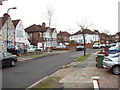
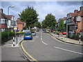
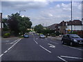
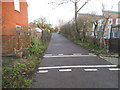
100 photos from this area
Area Information
Key information about the HA9 8PP including its size, population, and administrative classification.
- Area Type
- Postcode
- Area Size
- 7279 m²
- Population
- 1671
- Population Density
- 7090 people/km²
House Prices in HA9 8PP
21
Properties
£330,683
Average Sold Price
£82,000
Lowest Price
£735,000
Highest Price
Showing 21 properties
| Address | Type | Beds | Baths | Last Sale Price | Last Sale Date | |
|---|---|---|---|---|---|---|
| 14 Longfield Avenue, Wembley, HA9 8PP | Terraced | 3 | - | £505,000 | Feb 2020 | |
| 15 Longfield Avenue, Wembley, HA9 8PP | Terraced | - | - | £520,000 | Dec 2019 | |
| 20 Longfield Avenue, Wembley, HA9 8PP | Terraced | 3 | - | £735,000 | May 2017 | |
| 9 Longfield Avenue, Wembley, HA9 8PP | house | 3 | - | £340,000 | Apr 2012 | |
| 12 Longfield Avenue, Wembley, HA9 8PP | house | 5 | - | £363,000 | Nov 2011 | |
| 6 Longfield Avenue, Wembley, HA9 8PP | Terraced | 3 | 1 | £316,000 | Dec 2010 | |
| Corner House, Longfield Avenue, Wembley, HA9 8PP | house | 3 | - | £375,000 | Jul 2010 | |
| Henrietta, Longfield Avenue, Wembley, HA9 8PP | Semi-detached | - | - | £292,929 | Dec 2008 | |
| 13A Longfield Avenue, Wembley, HA9 8PP | Maisonette | 1 | 1 | £192,000 | Jun 2008 | |
| 7 Longfield Avenue, Wembley, HA9 8PP | Terraced | - | - | £312,500 | Dec 2006 |
Page 1 of 3
Energy Efficiency in HA9 8PP
Amenities
Schools
| Rank | School | Type | Entry gender | Ages |
|---|
Explore more schools in this area
Go to Schools tabDemographics
Household Size
Family (3-5 people)
most common
Accommodation Type
Houses
most common
Tenure
60
majority
Ethnic Group
asian_total
most common
Religion
N/A
most common
Household Composition
N/A
most common
Age
47
median
Adults (30-64 years)
most common
Household Deprivation
N/A
with no deprivation
NS-SEC
28
in Lower managerial occupations
Explore more demographic insights in this area
Go to Demographics tabPlanning
Planning Constraints
- Flood RiskPremium
- Ramsar Wetland SitesPremium
- Area of Outstanding Natural BeautyPremium
- Protected Nature ReservePremium
- Protected WoodlandPremium