Area Overview for HA9 7JP
Photos of HA9 7JP
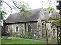
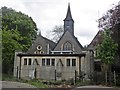
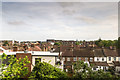
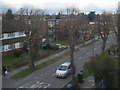
89 photos from this area
Area Information
Key information about the HA9 7JP including its size, population, and administrative classification.
- Area Type
- Postcode
- Area Size
- 1.9 hectares
- Population
- 2008
- Population Density
- 13073 people/km²
House Prices in HA9 7JP
47
Properties
£263,141
Average Sold Price
£38,640
Lowest Price
£600,000
Highest Price
Showing 47 properties
| Address | Type | Beds | Baths | Last Sale Price | Last Sale Date | |
|---|---|---|---|---|---|---|
| 121 St Johns Road, Wembley, HA9 7JP | Flat | - | - | £520,000 | Aug 2025 | |
| 99 St Johns Road, Wembley, HA9 7JP | Semi-detached | 4 | 2 | £570,000 | Jun 2025 | |
| 123 St Johns Road, Wembley, HA9 7JP | Flat | - | - | £250,000 | Jan 2024 | |
| 169 St Johns Road, Wembley, HA9 7JP | Semi-detached | 3 | 2 | £600,000 | May 2023 | |
| 119A St Johns Road, Wembley, HA9 7JP | Flat | 1 | 1 | £270,000 | May 2022 | |
| 159A St Johns Road, Wembley, HA9 7JP | Flat | - | - | £230,000 | Jun 2021 | |
| 139 St Johns Road, Wembley, HA9 7JP | house | - | - | £555,000 | Jun 2021 | |
| 119 St Johns Road, Wembley, HA9 7JP | Flat | 1 | 1 | £38,640 | Aug 2020 | |
| 115 St Johns Road, Wembley, HA9 7JP | house | - | - | £460,000 | Aug 2018 | |
| 131 St Johns Road, Wembley, HA9 7JP | Semi-detached | 3 | 1 | £430,000 | Aug 2015 |
Page 1 of 5
Energy Efficiency in HA9 7JP
Amenities
Schools
| Rank | School | Type | Entry gender | Ages |
|---|
Explore more schools in this area
Go to Schools tabDemographics
Household Size
Family (3-5 people)
most common
Accommodation Type
Flats
most common
Tenure
35
majority
Ethnic Group
asian_total
most common
Religion
N/A
most common
Household Composition
N/A
most common
Age
47
median
Adults (30-64 years)
most common
Household Deprivation
N/A
with no deprivation
NS-SEC
21
in Lower managerial occupations
Explore more demographic insights in this area
Go to Demographics tabPlanning
Planning Constraints
- Flood RiskPremium
- Ramsar Wetland SitesPremium
- Area of Outstanding Natural BeautyPremium
- Protected Nature ReservePremium
- Protected WoodlandPremium