Area Overview for HA9 7EE
Photos of HA9 7EE
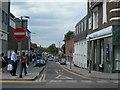
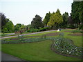
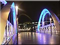
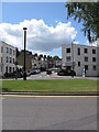
100 photos from this area
Area Information
Key information about the HA9 7EE including its size, population, and administrative classification.
- Area Type
- Postcode
- Area Size
- 1.1 hectares
- Population
- 1642
- Population Density
- 20811 people/km²
House Prices in HA9 7EE
45
Properties
£271,767
Average Sold Price
£60,000
Lowest Price
£550,000
Highest Price
Showing 45 properties
| Address | Type | Beds | Baths | Last Sale Price | Last Sale Date | |
|---|---|---|---|---|---|---|
| 6 Rosemead Avenue, Wembley, HA9 7EE | Terraced | 3 | 1 | £520,000 | Jan 2024 | |
| 8 Rosemead Avenue, Wembley, HA9 7EE | Semi-detached | 3 | 2 | £550,000 | Jul 2023 | |
| 14 Rosemead Avenue, Wembley, HA9 7EE | Terraced | 3 | 2 | £535,000 | Nov 2022 | |
| 15 Rosemead Avenue, Wembley, HA9 7EE | Retail | 3 | 1 | £530,000 | May 2022 | |
| 20 Rosemead Avenue, Wembley, HA9 7EE | house | - | - | £433,000 | May 2018 | |
| 12 Rosemead Avenue, Wembley, HA9 7EE | house | - | - | £380,000 | Jun 2015 | |
| 2 Rosemead Avenue, Wembley, HA9 7EE | house | - | - | £250,000 | Dec 2011 | |
| 13 Rosemead Avenue, Wembley, HA9 7EE | house | 3 | - | £272,500 | Dec 2006 | |
| 1 Rosemead Avenue, Wembley, HA9 7EE | Unknown | - | - | £144,000 | Nov 1999 | |
| 19 Rosemead Avenue, Wembley, HA9 7EE | Terraced | - | - | £96,000 | Oct 1999 |
Page 1 of 5
Energy Efficiency in HA9 7EE
Amenities
Schools
| Rank | School | Type | Entry gender | Ages |
|---|
Explore more schools in this area
Go to Schools tabDemographics
Household Size
Family (3-5 people)
most common
Accommodation Type
Flats
most common
Tenure
17
majority
Ethnic Group
asian_total
most common
Religion
N/A
most common
Household Composition
N/A
most common
Age
47
median
Adults (30-64 years)
most common
Household Deprivation
N/A
with no deprivation
NS-SEC
29
in Lower managerial occupations
Explore more demographic insights in this area
Go to Demographics tabPlanning
Planning Constraints
- Flood RiskPremium
- Ramsar Wetland SitesPremium
- Area of Outstanding Natural BeautyPremium
- Protected Nature ReservePremium
- Protected WoodlandPremium